
If you are just joining the fun on our fall Anniversary ride, you can go back and read the series from the start here.
In recent years, the popularity of iconic motorcycling roads such as the infamous ‘Tail of the Dragon’, with a reported 318 curves in 11 miles of US Highway 129 while crossing Deals’ Gap between Tennessee and North Carolina, has prompted other areas to create a buzz around their curvy roads to draw the motorcycle riding crowds.
Well, it worked for us. We had seen the Southwestern Virginia area advertisements to motorcyclists in several rider publications, including the BMW Owner’s News and Rider Magazine, and at their website, Visit Virginia Mountains, we found routes galore. This information was the basis for our visit to the Abingdon area.
The catchy road names include ‘The Back of the Dragon’, VA Highway 16 from Marion to Tazewell, ‘The Claw of the Dragon’, a map which encompasses multiple routes in the area, ‘The Snake’, 33 miles of US 421 from Mountain City to Bristol, TN, and a not-so-catchy page called Appalachian MC trails, which included 7 scenic and twisty routes, with turn by turn detail. These 7 routes included tiny, exciting and hidden roads you would never find on your own!
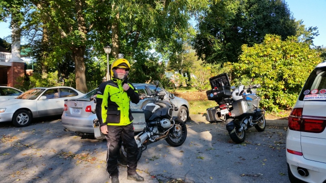
A brisk, sunny start to Day 2!
We started out day 2 with incredible weather; Sunny and cold, with the temperature in the high 30s when we headed out to meet our friend J. Our planned morning route was around 140 miles, and mostly curves! We headed out of Abingdon on US Hwy 58 South to the tiny town of Damascus, which is host to crossings of the Appalachian Trail, the Virginia Creeper bicycle trail, and numerous other gems of the Mount Rogers National Recreation area. It was here, a mere 14 miles from our start, where I stopped to take the first pictures of the day. It was to be a theme this day, two guys waiting patiently tapping their gloved fingers on their handlebars, while I stopped for pics again and again. 🙂
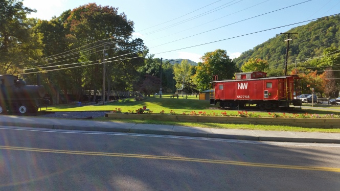
Previous rail, and now trail, crossings in Damascus
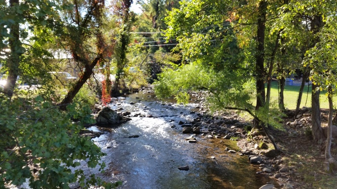
Laurel Creek provides water recreation and beauty
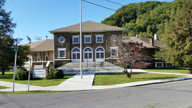
I love this commercial reuse of a beautiful old rock school building
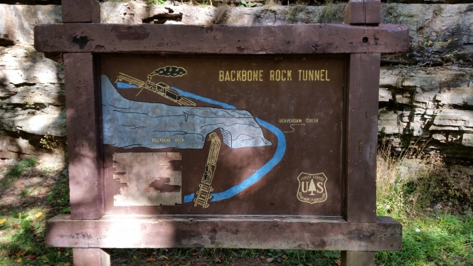
Just a few miles later, on Hwy 133 just inside Tennessee, we passed through ‘The Shortest Tunnel in the World’, Backbone Rock Tunnel. This tunnel was drilled into a natural ridge of rock, which just ends abruptly at a creek, in 1901 to allow railroad access between Damascus, VA and Shady Valley, TN. It is such a beautiful display of nature’s grandeur, and it fascinates me.
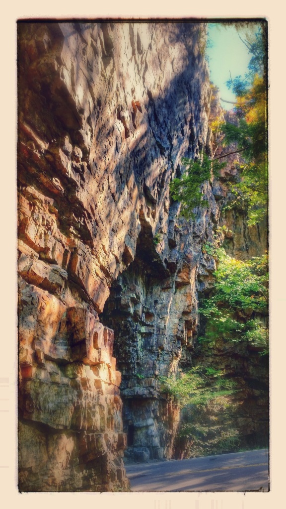
Backbone Rock
Interesting view of Backbone Rock
This view makes me wonder “Why didn’t they just cross the rail bed over the creek? Why drill a tunnel so close to the end?” Questions I will never know the answer to; just part of the wonderful mysteries of life.
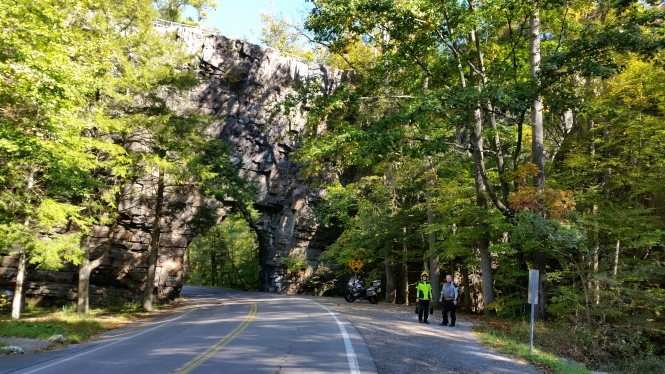
J and J pose in front of Backbone Rock tunnel – patiently
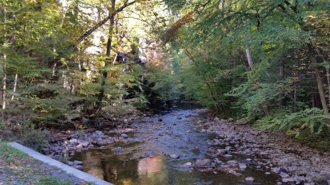
Beaverdam Creek
During this trip, purposely slower paced than our normal motorcycle trips, we gradually recognized that great riding roads so often run along the water. The original paths created by animals, and used by native peoples and settlers, followed rivers and streams along the valleys and then later became the curvy roads which we so enjoy today. The images of boulder-strewn streams fill the mountains of the Appalachians, reminding me of a giant’s abandoned game of marbles. The fragrance of the forest, the falling leaves, all added to the complete enjoyment of this day.
Our next stop, only a few miles further, was in Shady Valley, TN, midpoint of ‘The Snake’. The full Snake route claims to have 489 curves, three mountains, and one valley, and it will claim your full attention!
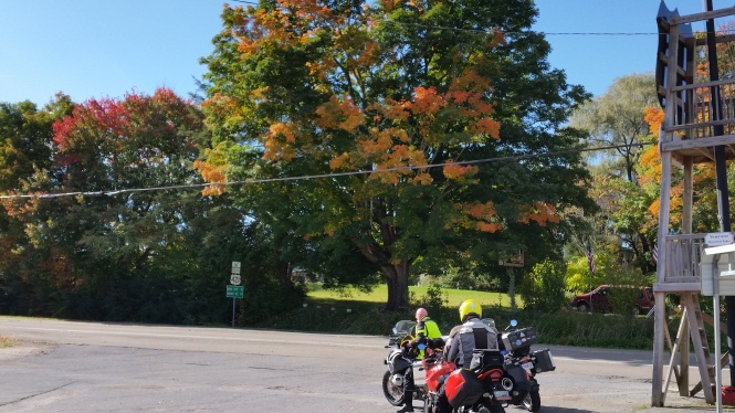
The guys and some fall color at Shady Valley
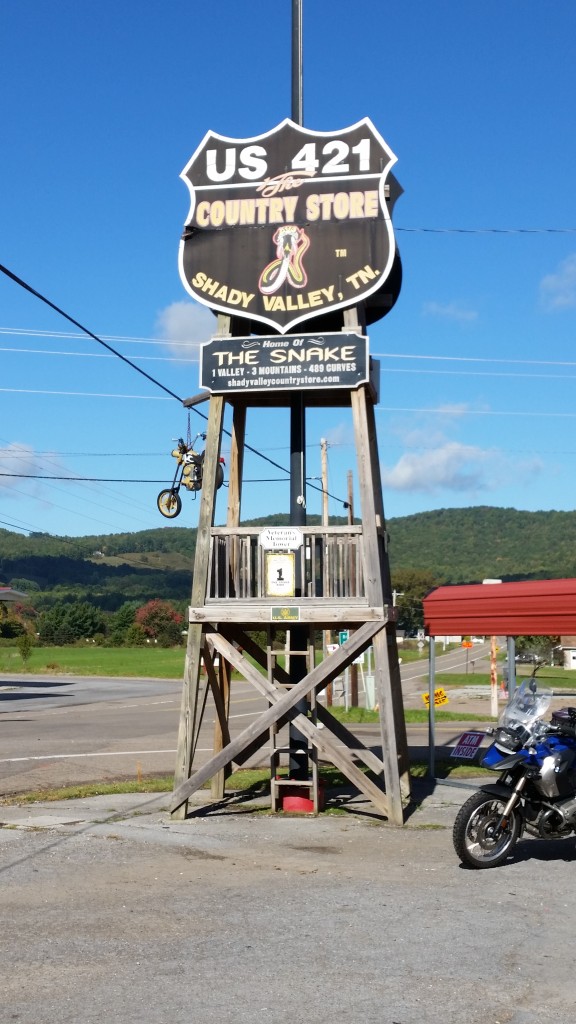
The Home of the Snake!
Our patient friend, J, had endured enough of our slow pace, and had a need for speed, so he went ahead to fly through the curves and then meet us in Mountain City. After a few minutes of checking our route for the rest of the morning, we made our own pass on the southern portion of the Snake, giving the technical nature of the road due attention, but enjoying the flow and the spectacular weather.
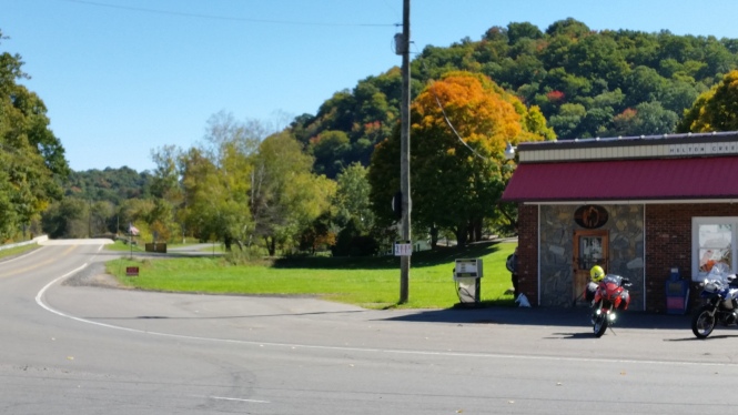
From Mountain City, we continued south and east into North Carolina, following our own variation of one of the 7 Appalachian MC trails called ‘To North Carolina Snake and Back’. This route led us on twisty back roads, through absolutely beautiful scenery, including a North Carolina and Virginia staple, the Christmas tree farm. We stopped at a crossroads store in Helton Creek for a quick break, and, of course, a few photos.
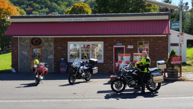
At the Helton Creek store
Another blast of fall color
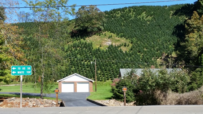
Steep hillside covered with Christmas trees
These very steep hillsides prompted a discussion of how these trees are planted; does machinery exist that can conquer this steep terrain and plant these perfect rows of evergreens? A lot of googling provided information that tree farming is a major agricultural business in this rocky and steep mountainous region, replacing lost jobs in manufacturing and growing of other declining crops like tobacco, but no details on how they plant on this difficult terrain. 😉
Our route continued on another portion of Hwy 194 in North Carolina, and back to US 58 into Virginia. The massive Mount Rogers National Recreation area includes Whitetop Mountain, Mount Rogers and Pine Mountain, and outdoor recreational opportunities abound. We stopped at the Elk Garden trailhead, which provides a view of the surrounding mountains.
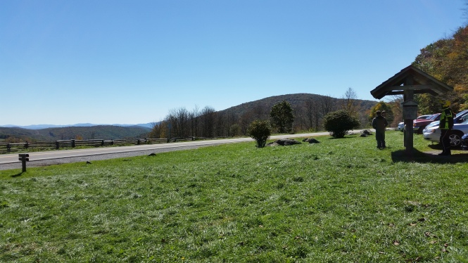
The view from Elk Garden trailhead
We followed VA Hwy 600 over Whitetop Mountain, which was aflame in autumn colors, then continued on Hwy 603 to Route 16 north into Marion for lunch. At lunch, we discussed the highlights of the afternoon’s ride, another customized version of some of the routes from the 7 Appalachian MC trails, covering another 130 or so curve-filled miles.
With tanks of both riders and bikes filled, we set a course North on ‘The Back of the Dragon’. This route will rival the best technical mountain road anywhere, with jagged rock cliffs covered in ivy and kudzu, and curves so tight, you can’t see where you’re going, much less if this particular turn is a decreasing radius, the archenemy of speed! On the downhill portion, we caught up to a Virginia local deftly piloting an older Goldwing, and reaching a breathtaking view of the valley below, we all stopped at an overlook. He was amused to hear we were from Georgia, and his comment was “you don’t have mountains like these in Georgia, do you?” I believe he was thinking of the low lands of Georgia, not the foothills of the Appalachians in our neck of the woods, but we just smiled and wished him a good day.
The Back of the Dragon overlook
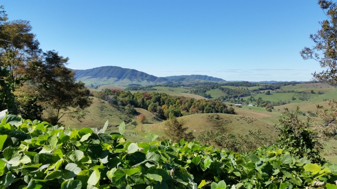
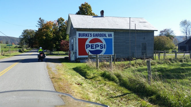
We continued on Va 16 through the quaint town of Tazewell and then turned east on Hwy 61 toward Burke’s Garden. We discovered this natural wonder several years ago through a chance meeting with the owner of Willville Bikecamp, a motorcycle campground at mile marker 177 on the Blue Ridge Parkway. He told us about this bowl-like valley, which is known for its fertile land and was once the bed of an ancient sea. The valley is about 8 miles long and 4 miles wide, and from the air it resembles a large volcanic crater, but Wikipedia reports that it was actually formed when underground limestone caverns collapsed. Burke’s Garden is accessed by VA 623, which is a fun and challenging road in both directions, and sits at near 3,000 feet elevation, completely surrounded by Clinch Mountain. This visit, we followed the loop road around the inside edge of the valley and were blown away by the beauty of the well-kept homes, expansive farms and gorgeous views.
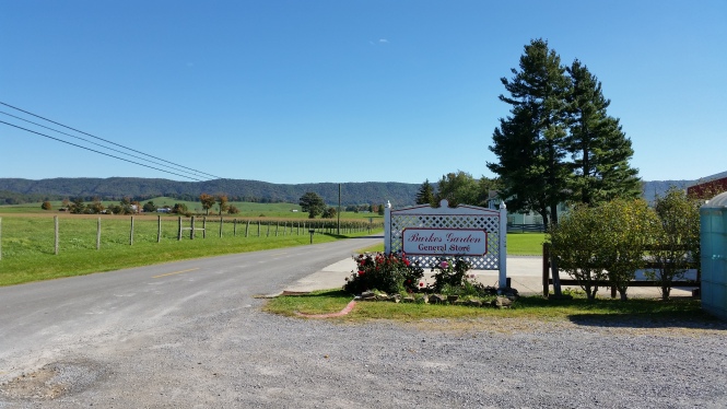
Burke’s Garden General Store – only game in town
The view behind the General Store, looking west
Looking east in Burke’s Garden
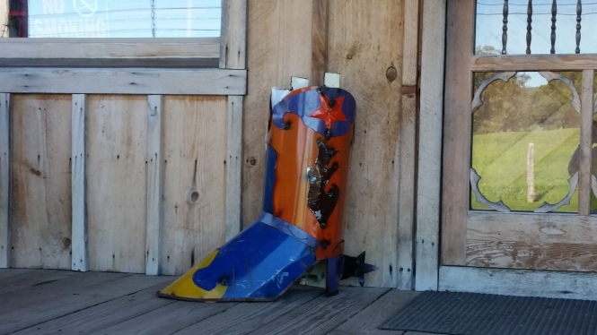
This fabulous boot was on the porch of the store!
Old Timey charm
As the day was growing late, we headed back down 623, and followed Scenic US 52 to Hwy 42 west, now facing into the sun on our way back to Abingdon, and beginning to bring on fatigue. A turn on Hwy 91 south took us through the town of Saltville, where the town signs proudly proclaim it the ‘Salt capital of the Confederacy’! We took a quick break here, and while I giggled out loud whether they had been told they lost, our southern friend J assured us the South isn’t giving up yet! And all kidding aside, the saltworks here were critical to the Confederate war efforts because the salt was used to preserve meats to feed both soldiers and civilians. The Confederates were successful in defeating Union forces in the Battle of Saltville in October of 1864, only to face defeat two months later.
All in all, it was a wonderful, albeit ambitious, day of riding, leading J to ask if we were going for the Iron Butt award. We assured him we were not, just trying to get the most of our riding opportunities. We wound up the day with a few adult beverages and some great Barbecue at the Bone Fire Smokehouse, but I covered that already here, in my post about Abingdon. Thanks for riding along!
Venture here to read about Day 3!


[…] here for more on the motorcycle riding in this lovely […]
LikeLike
What a lovely area of the country — the pics are just gorgeous. Almost too pretty to be real. Thank you for taking me along.
LikeLiked by 1 person
Dorcas, thank you for stopping by and the lovely comment. One photo might be slightly enhanced… 😉
LikeLike
You have successfully made me *consider* riding a motorcycle twice now. 🙂
Seriously though, what a gorgeous trek you had this day! I couldn’t help but wonder how awesome the hiking trails would be!
Awesome trip, Lynne!
LikeLiked by 1 person
Yay, Nancy, so I have met one of my goals! It is a lovely area and I am sure the hiking trails are amazing too. And we would love to go back and rent bicycles and ride the VA Creeper trail one day too.
LikeLiked by 1 person
Love your photos and love that you’re having a blast.
LikeLiked by 1 person
Thank you, Lynn! I can’t wait to get a real camera for retirement trips! And I am going to take some classes too. There is just so much I don’t know about photography!
LikeLike