
If you’ve been following along, in the last post, we were camping in our new RV near Hot Springs, Arkansas, and enjoying some relaxation and some riding. The day before we were to leave, I spent all day capturing two wonderful days of riding in a loooonnnggg blog post on my WP tablet app. I thought this was ok since the WP app had started working again, despite the problems I whined about shared here during our Texas trip in April. Well, WRONG! As I shared with my Facebook friends with dismay that evening:
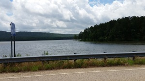
We leave the Ozarks early tomorrow morning, so I will leave you with a parting shot of the post-storm mist over Lake Catherine. And the sad tale of spending all day writing my last post about riding here and visiting Mount Magazine, Petit Jean and Mount Nebo State parks. Only to have the WordPress app eat my hours of work. Gone; disappeared into thin air. Wah, wah, get over it!
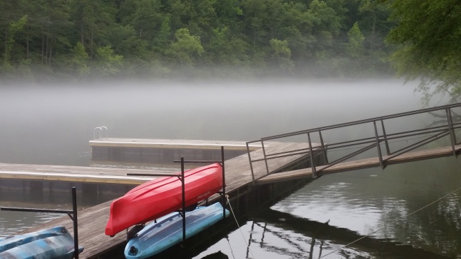
Eerie but cool mist over Lake Catherine
So, the riding in the Ozarks was so nice, and the scenery from these Arkansas State Parks so beautiful, I felt compelled to provide at least a ‘shorter’ version of the lost post. Ok, you out there, STOP laughing and wish me luck. Please.
Ride day # 2 was to Mount Magazine, which just happens to include the highest point in Arkansas. Now, while I would not consider us “highpointers” (really, it is a thing, click the link!), we certainly can include trying to reach the highest point in each state in our travels now that we are on our own schedule. We have already reached the highest point in Georgia, Brasstown Bald, at 4,784 feet in elevation, and Spruce Knob, the highest point in West Virginia at 4,863 feet. I imagine we have probably been to other highest points, but not that we recorded or remember off the top of our heads. Ha.
For those that like the route info, we left Hot Springs headed north on AR Scenic Route 7, which traverses almost the whole state and is lovely in all the areas we have experienced. Highly recommend.
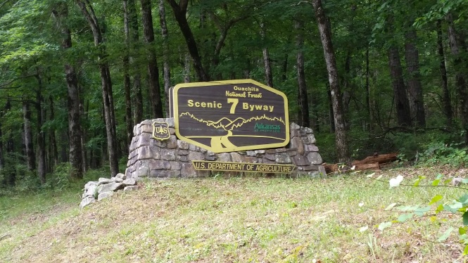
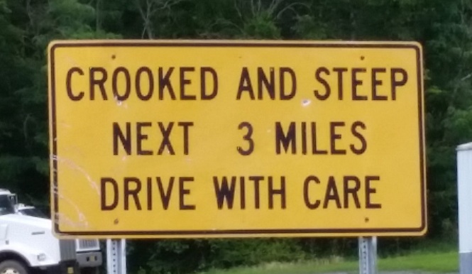
These signs are located on most of the scenic roads in Arkansas…nice!
We stopped to admire the massive amounts of water that Arkansas has received in recent weeks along Scenic 7:
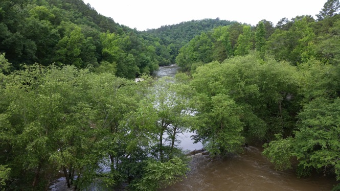
The Fouche La Fave River overflowing
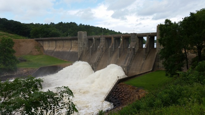
Tons of water being released from Nimrod Lake at the dam
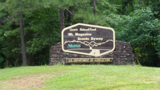
We continued on 7 north to the tiny town of Ola, then took AR 10 west to Hwy 309 North at the even tinier town of Havana. Hwy 309 is known as the Mount Magazine Scenic byway, you know how much I love signs…
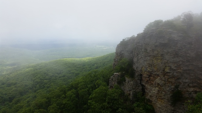
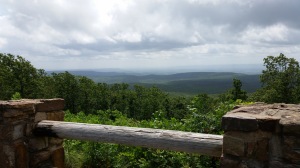
It also started to rain (suit up on side of road) and the mountain looked to be covered in clouds. No matter; we didn’t ride this far to turn around, no sir! So we proceeded up the mountain, and to our first set of overlooks in the clouds…so beautiful, and eerie!
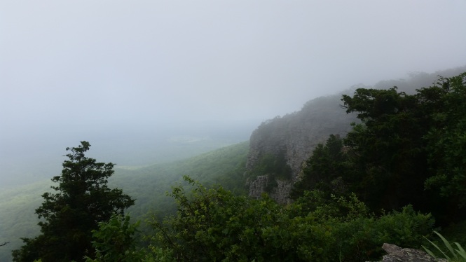
First overlook, totally socked in
Beauty abounds even in the clouds
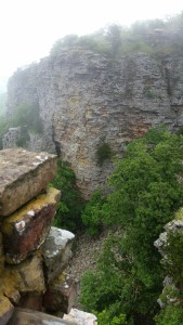
Headed to the second part of the overlook
Are the clouds parting?
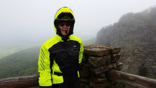
Nice rain gear, huh? Certainly good for visibility!
The view is starting to clear looking down
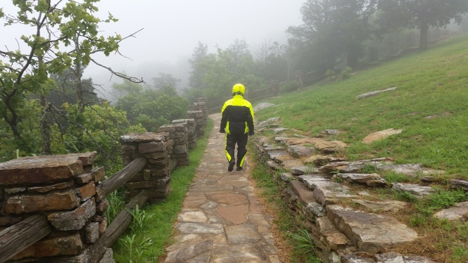
Up in the parking lot, still socked in. No crowds here.
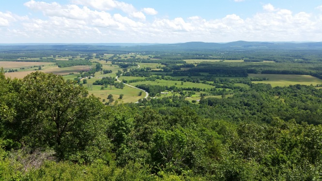
It was still early, so we decided to ride down the north side of Mount Magazine to check out the road and Cove Lake, in hopes that the clouds would clear for a view-filled lunch at the state park lodge. We were rewarded with these views down below:
About half way down the north side of the mountain
Cove Lake on the north side of Mount Magazine
Fingers crossed, we headed back up to the lodge, a fabulous timber frame structure with massive beams and giant windows, and these views of the Petit Jean River valley and Blue Mountain Lake.
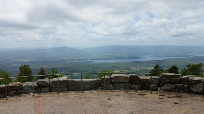
Incredible 180-degree views!
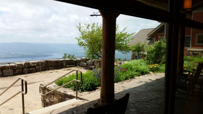
From one of the lodge porches
The Skycrest restaurant, named after the original lodge on Mount Magazine, is lovely, and it’s huge timbers and massive fireplace are said to reflect the “parkitecture” style of the 1930s. I just love that term!
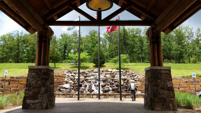
The massive main entry and gorgeous waterfall reflect the old lodge style as well.
We were so close to a highest point, off we went to hike to it. Not hiking gear, but really good riding gear 😉
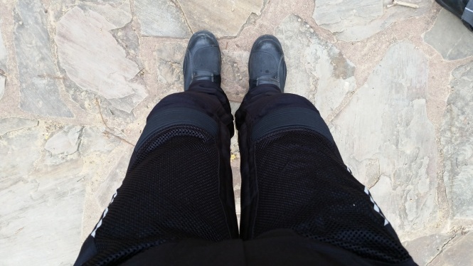
Armored pants and boots
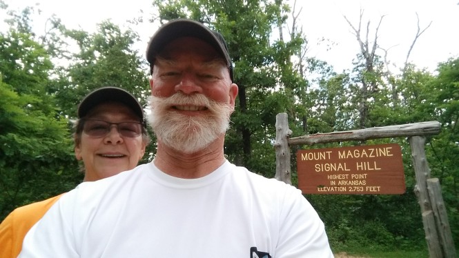
Highpoint selfie!
We were amazed at the number of signatures on the sign-in sheet and the personalized “high-pointers” stickers we saw at the top. Fun!
We retraced our route back on AR 309, then AR 10, to Danville, where I could NOT resist this shot.
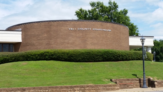
Yell County – snort
From Danville, we took really curvy AR 27 south to Mount Ida, which is a town, not a mountain. Or at least, we didn’t see the mountain. I’m not kidding, if you are in the area, you WANT to ride AR 27. Miles of smiles and curves! This sign is, as far as we know, only found in Arkansas. I love it and it signals the kind of road curvyroads lives for!
LOVE this!
Ride day #3 was totally unplanned and began with an errand to Conway, Arkansas to get to a Bank of America. Seriously. Not even a BoA ATM within 45 miles of Hot Springs. Hmmm, so let’s plan a ride around our errand. 😀
We noticed that Conway was not too far (in motorcyclist terms…) from Petit Jean and Mount Nebo state parks. Off we went, north again on Scenic 7, a right on AR 5 east, then a left on AR 9 north. All of a sudden, we see a flagman, and 10 or so vehicles stopped in front of us. We knew we were a hair away from our next turn on AR 10, but alas, there was no getting there. It was still early-ish, so we were able to stop the bikes in the shade, but it was starting to get warm. Then the FedEx guy turned around. Hmmm.
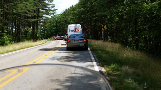
Road blocked ugh
A truck pulling a camper pulled in behind us, and a man got out and went rummaging around in a cooler in his truck bed. Then he did something that blew us away. He brought us each an ice-cold bottle of water!!!!! Faith in humanity restored!
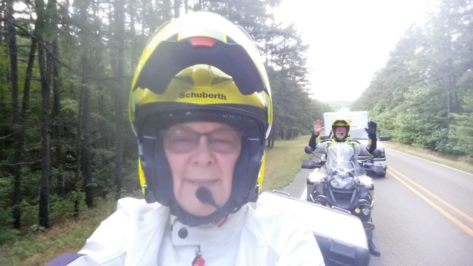
Selfie with our kind friend’s truck and camper in the background
So, a mere 40 or so minutes later, a pilot truck comes to lead us around whatever has held us up all this time. It was a GIANT houseboat. Accompanied by a GIANT tow truck, some wide load escort vehicles, and assorted others. We don’t know if they dropped it, or couldn’t get it around a tight turn, who knows? Anyway, we were again on our way.
At Williams Junction, we went left on 113, then right on AR 60, and then, just before we reached Conway, THIS happened. I had to get a shot for my blog-friend Kathy at Toadmama. Check her out, she is funny and a traveling rider/writer; you’ll like her, I promise!
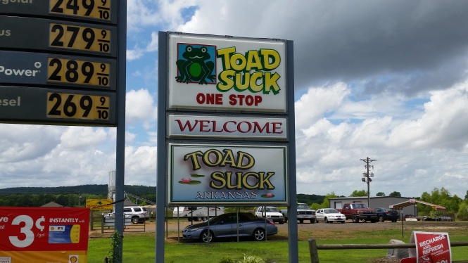
Toad Suck, Arkansas
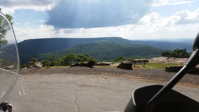
So, in Conway, which is a real town with stop lights and traffic and such, we went first to the bank, then grabbed a quick lunch. We headed west on US 64 to Morrilton, where we caught AR 9 south this time, to Petit Jean Mountain road. We were in the Arkansas River valley now, and we could see the rocky tip of Petit Jean mountain for miles as we rode surprisingly twisty valley roads, following streams and veering around large tracts of fertile farmland. Darned if we didn’t ride right up to that rocky tip at Stout’s Point overlook in Petit Jean State Park. There is an interesting legend about Petit Jean (Little John) that you can read in detail here, but the readers digest version is that a French woman desperately wanted to travel to the new world with her explorer fiance, but was spurned due to the danger, disguised herself as a boy, stowed away on the ship, became a part of the exploration team as “Petit Jean”, got sick and died, and was buried on Petit Jean mountain.
Seriously, the views here are ‘to die for’. Yuck, I know, not funny.
We approached Petit Jean on this curvy road
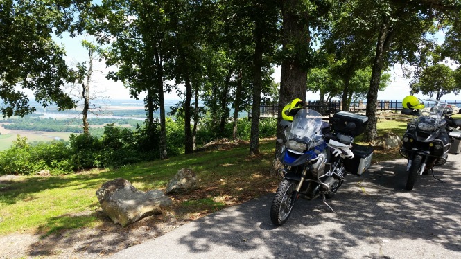
Our bikes at Stout’s Point overlook
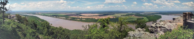
Panoramic view of the overflowing Arkansas river and the surrounding valley
Some of the massive boulders on the point
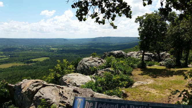
Southwestern view
We continued west along AR 154 through Petit Jean State Park, which had lovely camping and RV sites, and was ramping up for a car enthusiast show that coming weekend. Lots of RVs and classic cars were on their way to the mountain in preparation.
We passed through a town called Pontoon, and then the Hola Bend nature preserve. Where do they get these names??? They were good for a chuckle, that’s for sure!
We rode through Centerville and hopped on Scenic 7 north to Dardanelle, where we went briefly south on AR 155 to Mount Nebo State Park, our last stop of the day. It was now getting late in the afternoon, and riding into the sinking sun was draining. We rode up to the top of Mount Nebo on the absolute twistiest road of the entire trip! I am not kidding, there were TWO MILES of 10 MPH turns. Awesome on a motorcycle, not so much in a car. LOL
We did the only reasonable thing: went to the visitor’s center and bought two Klondike bars, then enjoyed them on the porch…with this view.
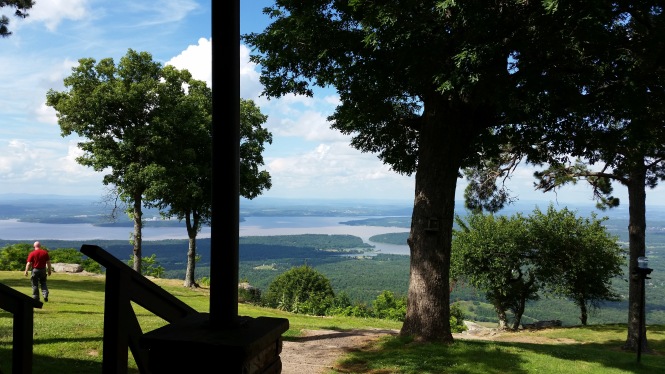
Ice cream tastes even better on this porch
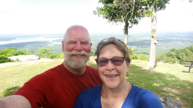
Mount Nebo post-Klondike selfie
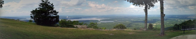
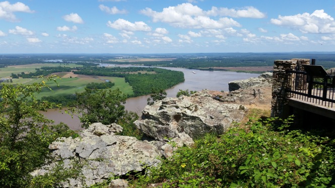
panoramic view of the Arkansas river valley from Mount Nebo
We rode to both Sunrise and Sunset points on Mount Nebo. Both were spectacular. We rode back to Hot Springs on Scenic 7. And we leave you, most appropriately, with this shot of Sunset Point. Thanks for indulging me, and reading the short version of our rides in the Ozarks. 😀
The perfect final shot…Sunset Point


Hmmmmm, for a minute I thought it was describing a person!
LikeLiked by 1 person
Lol, Cindy…hilarious!
LikeLike
Great pix and commentary – and you can never go wrong with a klondike bar – they stay well in RV freezers too. Just sayin…. What great adventures!
LikeLiked by 1 person
Thanks, Lynn! It was so much fun and such unexpected beauty. Yes to ice cream 🙂
LikeLike
I LOVE your pics. And those scenic byway signs are awesome. At first, I thought the part you thought would amuse me was your reference to highpointers. I know they’re a thing. I’m not one either, but who can resist visiting a high point when nearby? 🙂 I just added South Carolina to my list, just because I was close. LOL. Then I saw the Toad Suck sign. You’re right, that’s an awesome town name. If I ever get back to Arkansas, I’ll have to be sure and visit. The Ozarks are a great place to ride. Thanks for the shout-out!
LikeLiked by 1 person
Yay to highpointing! We will definitely seek them out now. Toad Suck…I just want to keep saying it, lol! Glad you got a smile out of it and I hope you get to see it in person! Anytime, love your blog!
LikeLike
What a gorgeous place! Thanks for sharing this beautiful part of the country with us!
LikeLiked by 1 person
Thank you for reading and commenting! Are you back in Atlanta anytime before the 15th of July? We are headed out again on the 15th, but would love to see you if you are here.
LikeLike
Nope, sorry. 😦 I’m headed to Vegas tonight – there through the 11th of July. Then I’m down in New Orleans from Jul 26th thru the 31st.
LikeLiked by 1 person
Oh enjoy Vegas, AND New Orleans, and I will catch you on the closer-to-fall side!
LikeLike
[…] Another fine day in the life of the RVing, motorcycling, curvyroads gang! Thanks for reading and following along. You can go straight to the next installment of this story by clicking here. […]
LikeLike