
Welcome back to the tenth installment of the Bucket List: Alaska series. If you are just joining us, you can go back to read the start of our Alaska adventure in Anchorage at this link. There will be links at the bottom of each post to take you to the next one.
Our second day aboard the Star Princess was one of the highlights of the entire Alaskan trip, an entire day spent in Glacier Bay National Park, which is unique among the treasures that make up the National Park system in its inherent impermanence, as well as, that it can only be visited by boat or plane.
From the National Park Service brochure for Glacier Bay:
“Tlingit people had occupied the area for countless generations, living in the shadows of glaciers, prospering from the bounty of the land and sea. Captain George Vancouver had sailed the area in 1794, and created a rough map that showed the bay filled with a single great glacier. Eighty-five years after Vancouver, naturalist/preservationist John Muir had visited the bay by canoe, and found the glacier receding as fast as a mile per year.”
“To the lover of pure wildness Alaska is one of the most wonderful countries in the world.” …”it seems as if surely we must at length reach the very paradise of the poets, the abode of the blessed.” John Muir, Travels in Alaska
Beginning with the efforts of a plant ecologist from Minnesota named William S. Cooper, who first came to Glacier Bay in 1916, the preservation of this untamed wilderness was won in 1925 when it became a National Monument. Fifty-five years later, President Jimmy Carter signed the Alaska National Interest Lands Conservation Act that created Glacier Bay National Park and Preserve. If only we had such enlightened leadership in this country today. 😦
Glacier Bay is a wilderness, a national park, a United Nations biosphere reserve, and a world heritage site. Just 250 years ago, Glacier Bay was all glacier and no bay; 100 miles of ice, which was thousands of feet deep. Today, that glacier is gone, having retreated north, and fewer than a dozen smaller tidewater glaciers remain. Though you will see the remaining glaciers are still impressive, if seeing these wonders is on your bucket list, I recommend you do it sooner rather than later.
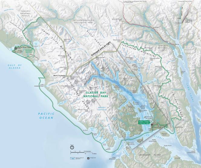
Glacier Bay National Park Map (photo courtesy of the National Park Service)
Princess does a fabulous job of making information available to guests, and this morning was no different. A team of rangers from Glacier Bay approached and boarded the ship early in the morning, using the same process as the local ship pilot in Yakutat Bay. At 10:00AM, two female rangers shared a presentation in the Princess Theater on the history, logistics, and operation of the park, as well as, the flora and fauna, and most importantly, the glaciers. One ranger also shared, in words, photos, and video, her two-week solo kayak trip into the wildest areas of Glacier Bay, accessible only by small craft such as a kayak. Suffice it to say, she is one BAD ASS woman! Facing bears, extreme weather (even in summer), exhaustion, and overwhelming beauty makes for a very captivating presentation! There was a ranger station open all day, providing maps, souvenirs, children’s presentations, and Q&A as we made our way up to the furthest point in Glacier Bay at Margerie Glacier, which we reached about mid-day. The Glacier Bay experience was further enhanced by the Rangers’ running commentary over the deck loudspeakers during our visit, drawing our attention to glaciers calving, marine life and bald eagle sightings, and other points of interest.
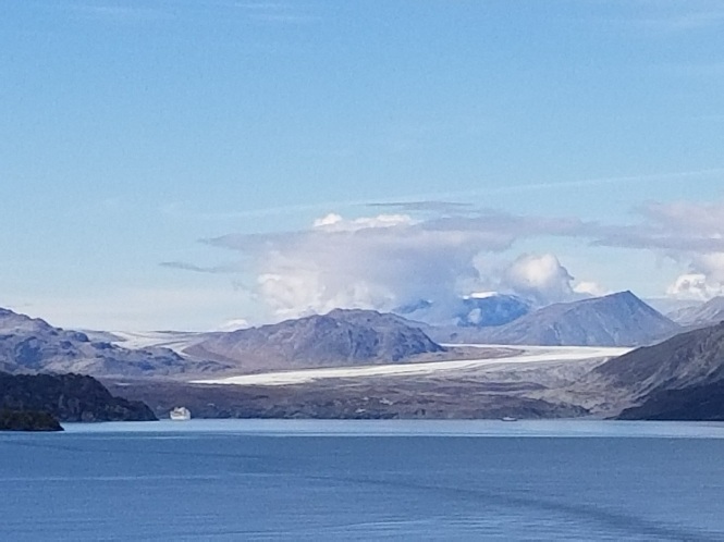
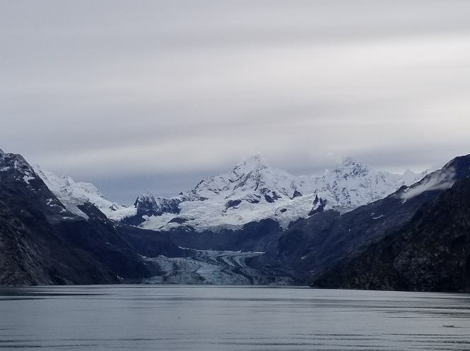
Within the 3.3 million acres of the National Park and Preserve are portions of the Fairweather, Takhinsha, and Chilkat Mountain ranges, the Brady Icefield, ~ a dozen named glaciers, countless islands and coves, the Bay itself, and several inlets. Our cruise through the Sitakaday Narrows into the bay covered 65 miles each way, and views of the famous Margerie, Johns Hopkins, Grand Pacific, Lamplugh, and Reid glaciers.
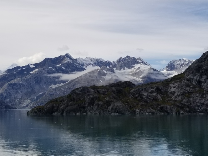
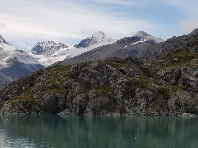
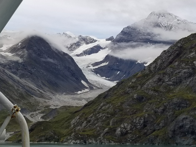
Here are a few shots from our cruise toward Margerie Glacier.
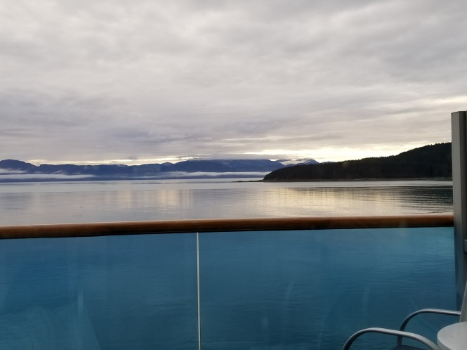
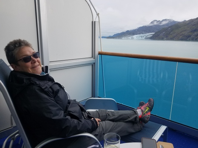
From our balcony – cruising North up Glacier Bay
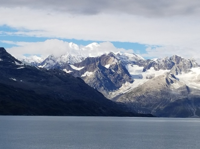
Magnificent mountain views
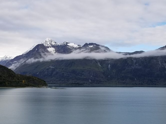
Wispy clouds floating over the mountains
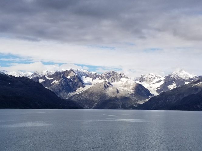
Jaw-dropping scenery!
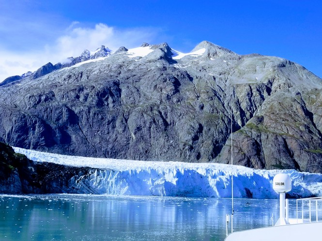
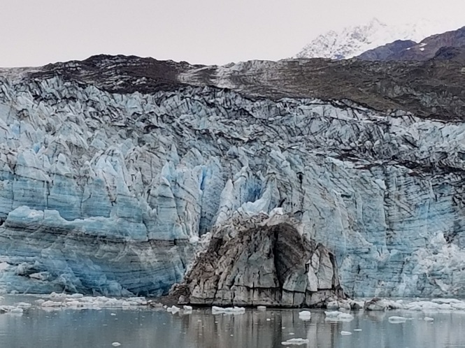
Margerie Glacier, at the northwest end of Tarr Inlet, is the star of the show, at over a mile wide, and soars a mindblowing 40 stories in height. I will just let the photos do the talking from here.
Yes, this is filtered…an attempt to recreate the insane color of real life!
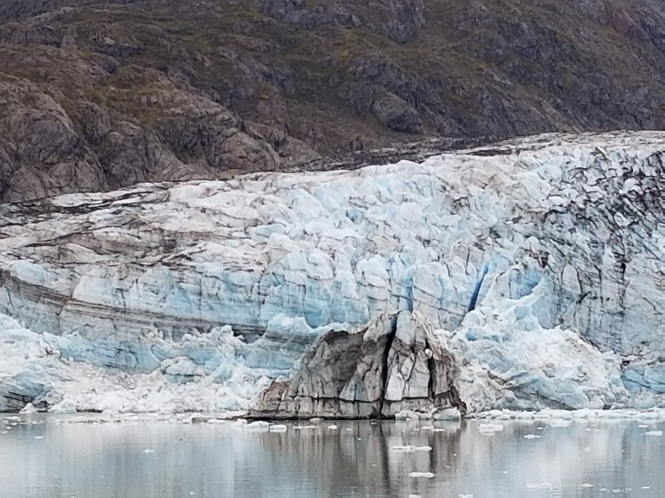
This photo shows the glacial silt that looks like dirt on the edge of glaciers
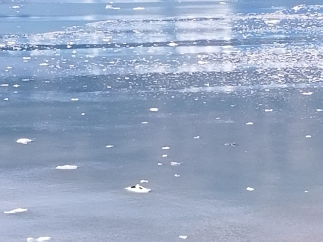
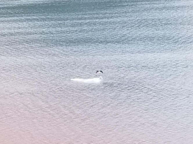
The two tiny black dots on the iceberg are actually huge sea lions
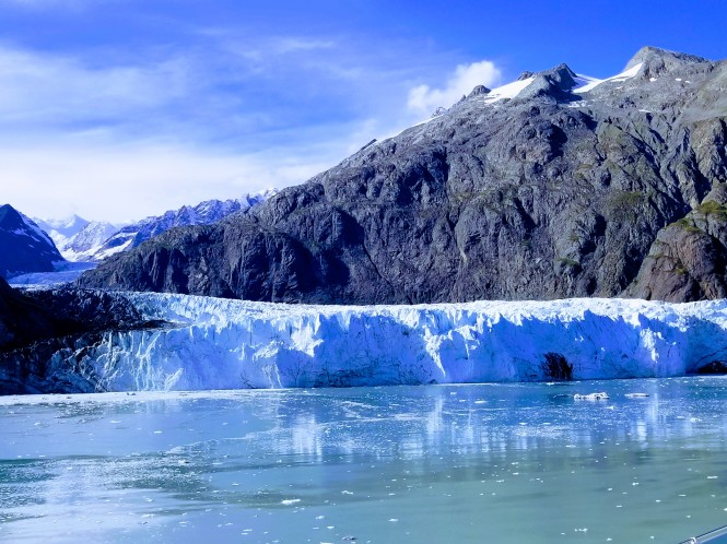
Close to the incredible color that we actually saw
Looking far into the depths of the glacial valley
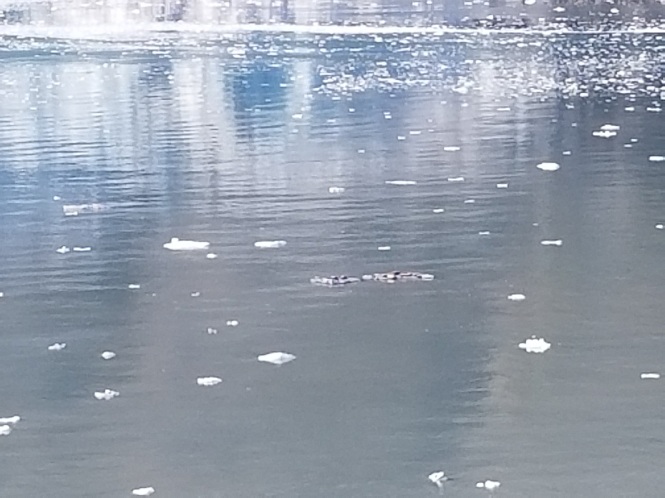
Another larger group of sea lions
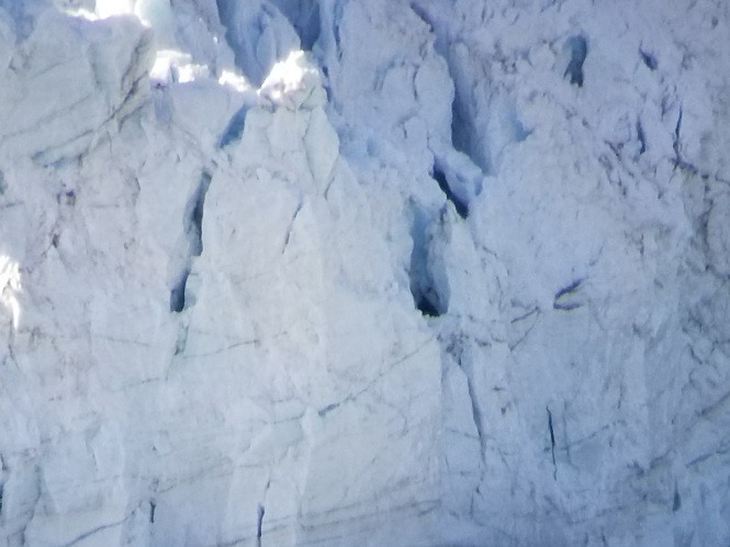
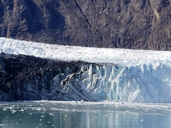
Close up of the Glacier
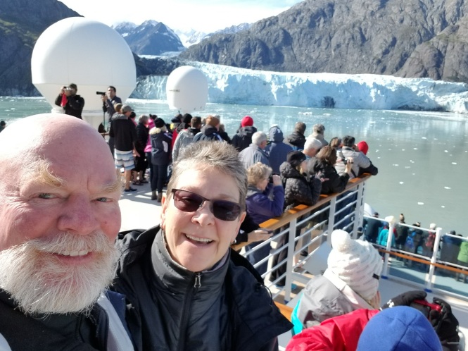
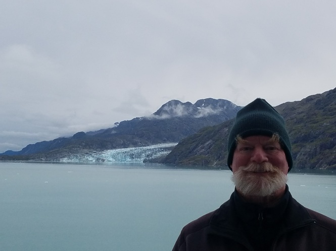
Gratuitous top of ship selfie
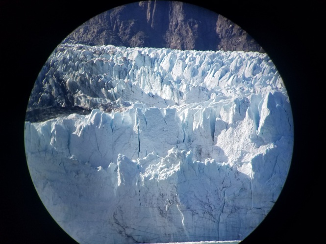
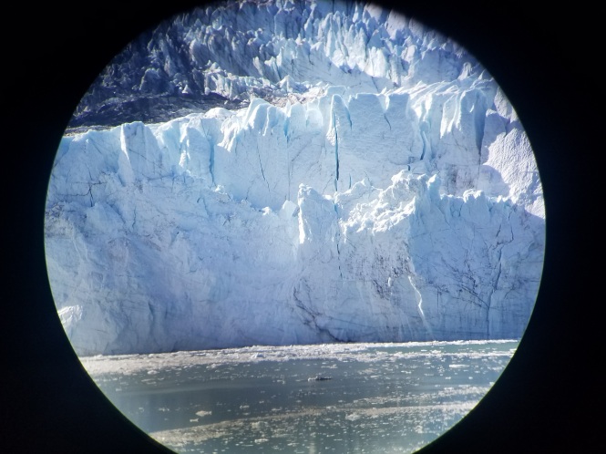
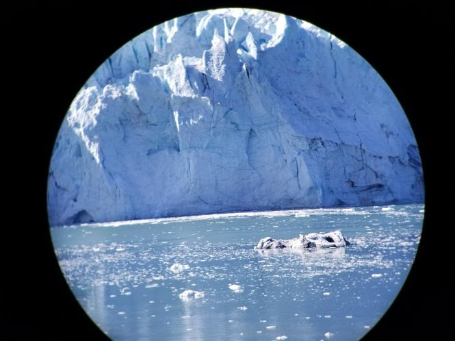
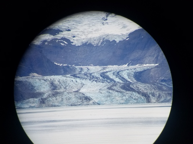
My husband Jerry came up with the AMAZING idea of taking a photo through the lens of our incredible Swarovski binoculars. The following three photos are his, and show a level of detail that blew us away!
A wider view of Margerie as we depart Tarr Inlet, with another cruise ship in view
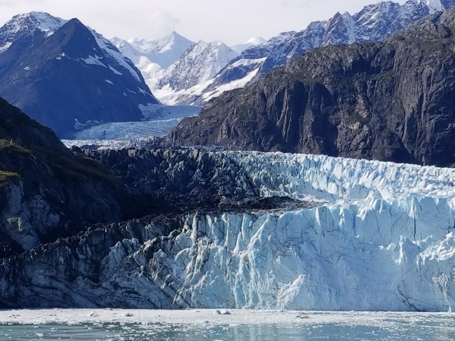
The ship then cruised up into Johns Hopkins Inlet, but not as close to the glacier this time.
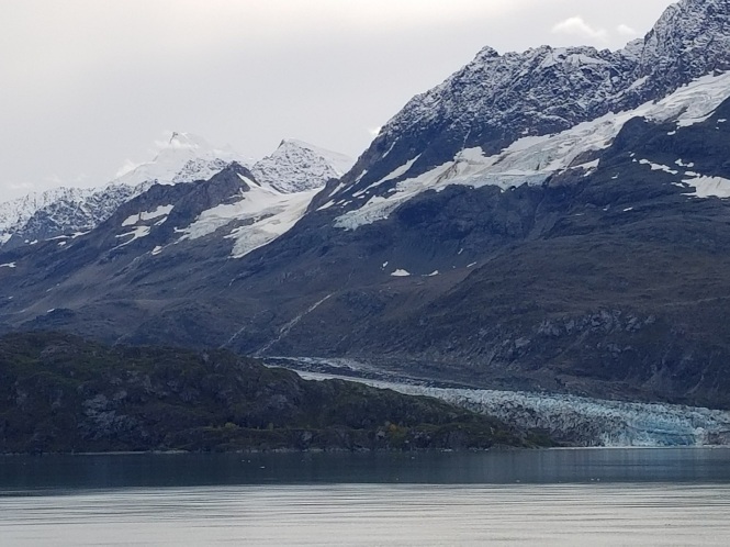
Johns Hopkins Glacier
The following are photos from the cruise between Margerie and Lamplugh Glaciers.
Breathtaking!
A bald eagle sat on a rock as the ship got closer, and then finally, too close
Grand Pacific Glacier in the distance
Grand Pacific up close courtesy of Jerry
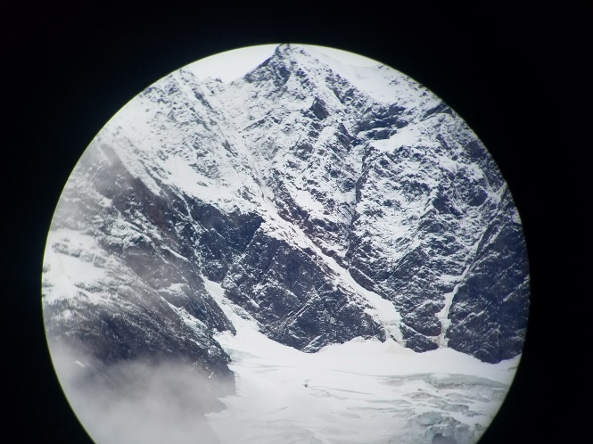
Detail of the mountains above Grand Pacific, again from Jerry
Last, but not least, a few shots of Lamplugh Glacier. It was probably the afternoon light, but these photos get a lot closer to showing the actual crystal blue color we were seeing in person.
From the Princess guide to Glacier Bay: “Why does the ice look blue? When light hits highly compacted glacier ice, long wavelength colors (reds) are absorbed, while short wavelength colors (blues) reflect back through the ice to your eyes.”
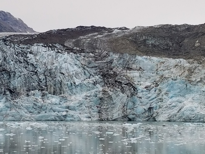
The dirty look of some areas of the glaciers comes from avalanches, rock slides, tributary glaciers, and the scouring of the valley causing accumulation of dirt and rock within the ice.
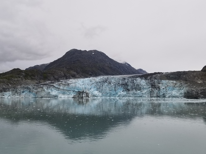
Lamplugh Glacier
It was an incredible day in one of the natural wonders of the world! Later, we relaxed on the balcony with an adult beverage, watching the scenery and the rangers departing the ship back to their park headquarters.
On a sad note, the ship’s departure from Bartlett Cove, where the rangers disembarked, was delayed. We found out later that the delay occurred while an airlift was arranged to a hospital due to a medical emergency. We wish all the best for the patient and family.
Thank you for bearing with me through lots of words, and even more photos! I hope you enjoyed the virtual visit to a national treasure!
Join me next time for a visit to Skagway, with its Gold Rush-era history, and a couple of fun excursions. Click this link to go directly to the next post.


[…] You can go directly to that post by clicking this link […]
LikeLike
Such a beautiful area. How sad the glaciers are melting so quickly. At this rate, tourists will be sunbathing in Alaska. 😦
LikeLiked by 1 person
I know Carrie, it is heartbreaking. And heartbreakingly beautiful…
LikeLiked by 1 person
Gorgeous photos!
LikeLiked by 1 person
Thank you so much Cindy! 😀
LikeLike
wow!! So beautiful!!! Sounds like a trip of a lifetime!
LikeLiked by 1 person
Thank you, Lynn, it really was! 😍
LikeLike
Great photos! One of these years I may make it to Glacier Bay.
And on the previous post, my comment was referring to the smaller boats operating out of Seward.
LikeLiked by 1 person
Thank you, Richard! I really, really recommend a visit. And on a smaller boat, you would be able to get SO much closer than the cruise ships are able. Even on the behemoth, it was breathtaking.
And my clarification on the earlier comment was because many of the big cruises go out of Seward too, and that was an option when we were deciding on our itinerary. If I were to go back, I would do all our travel on smaller boats or ferries for the more intimate experience.
LikeLike
Stunning!! Such gorgeous pictures of the scenery. Smart move by Jerry to use the binoculars for the pictures.
Sad that our current administration would like to open up Alaska refuges and natural areas for drilling. If only we had someone more aware (and less greedy) in office.
LikeLiked by 1 person
Thank you for your kind and complementary comments, Brandy! 😍
Yes, our political debacle makes me sick, and though I know (hope?) It’s not forever, the idea of the damage that this lunatic can do in 4 years frightens me beyond anything I can remember. 😢
LikeLike
Stunning!
LikeLike
Thank you Nancy! It absolutely was, and I am so glad that came through in the photos.
When you are gazing at something so monumental and mind blowing, you wonder if it’s even worth an attempt to capture the moment. Of course l am always compelled to try anyway 🤣
LikeLiked by 1 person
Beautiful pictures! I’m slightly jealous that you have Swarovski’s…their optics are second to none!
LikeLiked by 1 person
Thank you, MV! Yes, the Swarovskis were recommended by friends, and initially we balked at the price, but you are right, the optics are the best. We didn’t spring for the big daddy version, but absolutely love ours.
LikeLiked by 1 person
The last frontier. I’m going to get there someday… hopefully it’s also on two-wheels!
LikeLiked by 1 person
Alaska on two wheels would be amazing! Just make sure to take a boat to Glacier Bay! 😁
LikeLike
Note taken!
LikeLiked by 1 person
Cool pics!
See what I did there?
LikeLiked by 1 person
Always the wordsmith, my friend 😍
And thank you for visiting!
LikeLike