
As I type this post, in early August, we are beginning to notice hints of fall in the Rockies, although the crowds in Estes Park and Rocky Mountain National Park (RMNP) still scream of summer! 😉 Today I will describe a hike on July 24th, a Tuesday, where we got an early start which allowed a peaceful and uncrowded hike up to Twin Sisters Peak, but then we encountered the masses going up as we headed down in the early afternoon. Yes, it was a long hike!
A co-worker here at the campground had hiked Twin Sisters some time back. He said it was challenging but doable. He is somewhat younger than Jerry or me and must be in good shape, as he completed the hike in under 5 hours. I must admit, I was daunted, as the Twin Sisters peaks loom large in the southern view from the campground, and the total round trip distance is around 7 miles. The trailhead is only 4 miles from our door, though, so we had to do it!
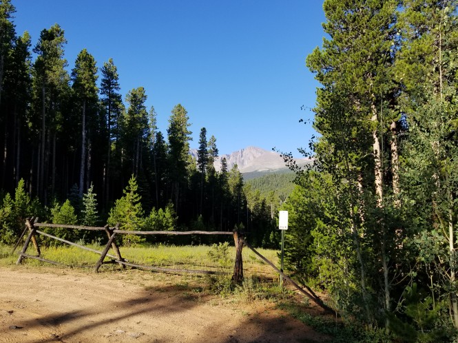
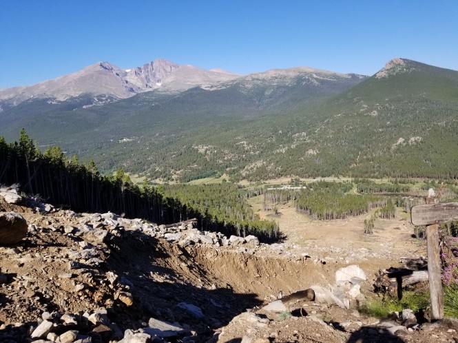
View of Longs Peak from the Twin Sisters trailhead
We started out around 7:45 AM (I know, that is not early for everyone!) and there were only a few cars at the trailhead. We noted one car had an “Ultra Runner” bumpersticker…more on that later. The starting elevation is 9,090 feet. The trail starts out through a gorgeous pine forest, and due to the orientation of the mountain, you are in the shade in the morning. Bliss for these two sun-averse hikers!


The trail goes gradually up the west side of the mountain initially, then heads generally south across the side. At this point, we passed a woman who was running back down…this by a little after 8 AM. Wow…that must be our ultra-runner!
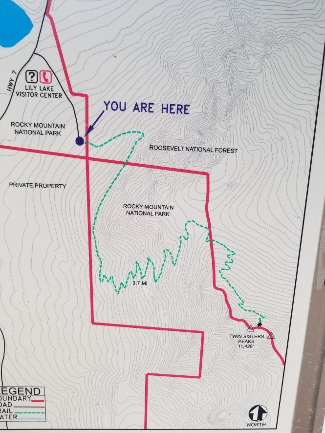
The trail starts in RMNP, then passes into the Roosevelt National Forest, then back into the park. At about one mile in, there is a spectacular view of Longs Peak so we took in the view and took a couple pics of each other as well. 🙂
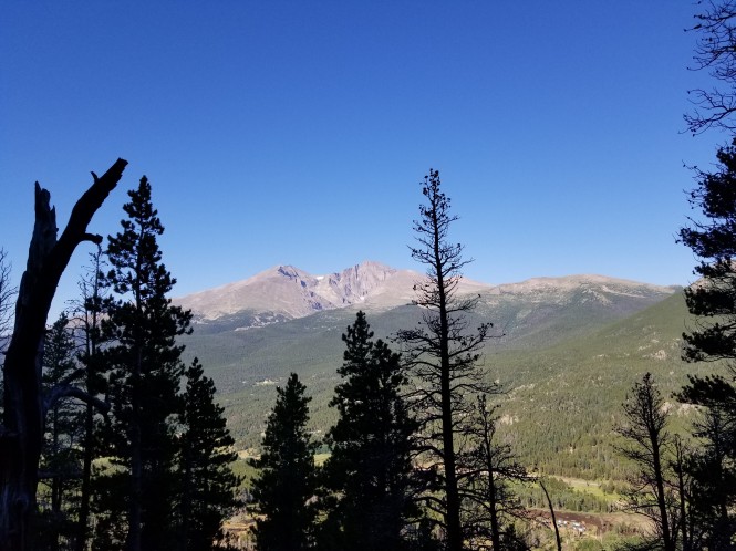
Longs Peak to the west
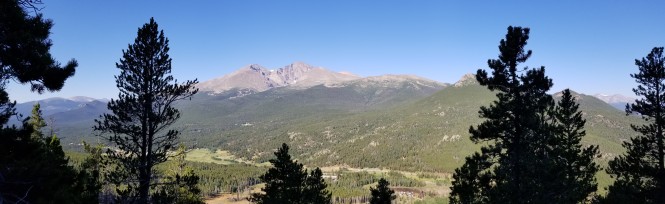
Panorama of Mt Meeker on the left, Longs Peak on the right
At about 1.3 miles, we reached the crossing of a massive landslide caused by the flood of 2013. The landslide actually destroyed several of the switchbacks on the trail, so a crude trail cuts across the slide, then switchbacks continue pretty drastically uphill on the south side of the slide. The slide is huge and can be clearly seen from CO Hwy 7.
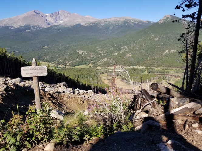
The first view of the landslide area
Looking down the slide to CO Hwy 7
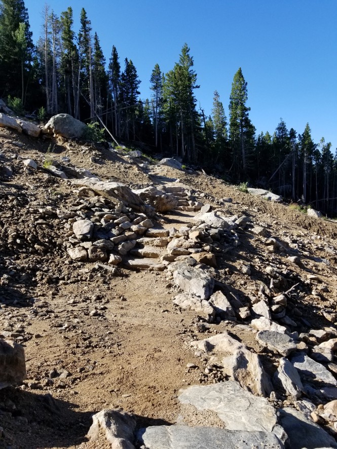
The crude trail across the landslide
This type of landslide really gives you an idea of the immense power of Mother Nature! The flood of 2013 was caused by a massive rainfall, about 11 inches over the span of a week in the Estes area, preceded by a period of drought. In this case, the mountainside just slid down, causing a gash in the landscape of epic proportions. It is truly humbling to stand in the middle of something like this. Talk about feeling small and insignificant…
Looking up at the landslide from the other side
Once on the south side of the slide, the switchbacks are steep, and this is probably the most difficult portion of the whole hike. We took our time, rested when necessary, and did not break any speed records. 😉 During this portion, we met a family from Iowa on their way back down. They began hiking in the wee hours with headlamps in order to experience sunrise from the summit. And they were basically discovering the sights since they were unable to see anything on the way up! My heroes!
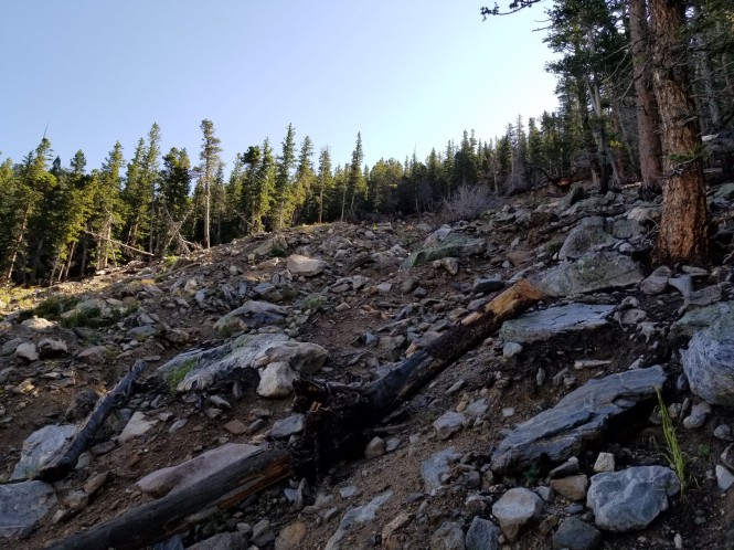
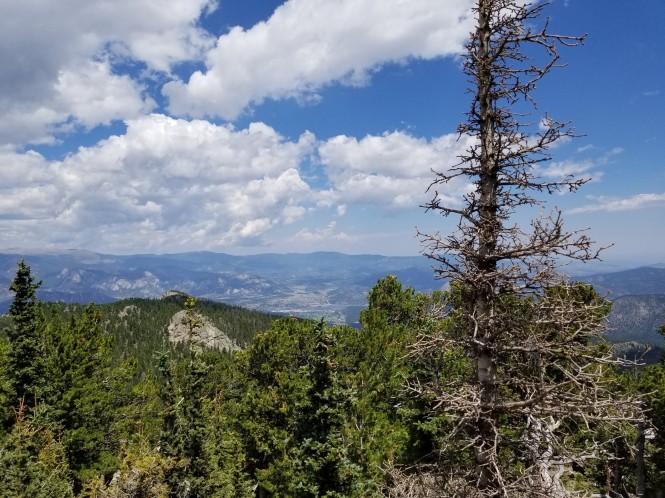
As we continued to climb higher, we noticed signs of the trees struggling to survive the high elevation and challenging weather conditions. The views increased as the trees thinned out as well.
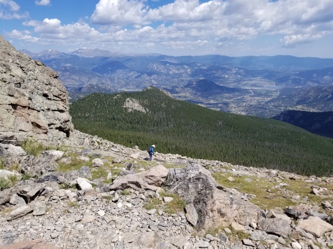
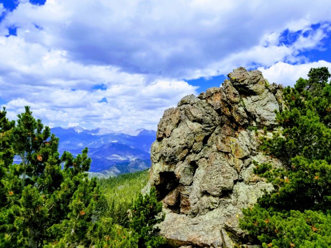
At about 3 miles we reached the treeline at approximately 11,000 feet in elevation, and the trail becomes a hike across a boulder field that faces east. It is a totally different view from the previous sections of the hike and it is awesome!
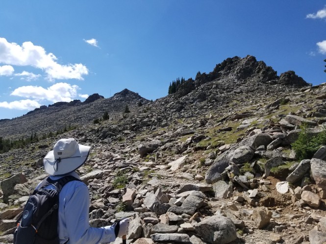
Jerry looking south across the boulder field, there IS a trail there, I promise!
On the boulder field, we met a man named Jim, who proudly declared himself 79 years old, and with one more big hike for the 2018 season after Twin Sisters, to Flattop Mountain. Jim said his wife moved to Estes with him 8 years ago so he could get his fill of hiking. It was inspiring to meet him, still hiking at 79, but also sad as he said he thought this was his last hiking season. He said his wife was worried about him falling and wanted to move to Florida. 😦 He was moving VERY slowly and said he liked it that way.
Jim carefully picking his way across the boulder field on his way down Twin Sisters
At the top of the boulder field, you reach the saddle between the East and West peaks, thus the name Twin Sisters. There are a radio tower and old stone hut at this point reportedly used for locating lost hunters and downed aircraft.


We followed the route to the right, around the stone hut to the summit. Once there, we found out that was the West peak, at 11,413 feet in height. The East Twin Sisters Peak, at 11,428 feet, is slightly higher than the west peak, but we were ok with the 15 feet shortfall, and still consider that we reached the summit. 🙂
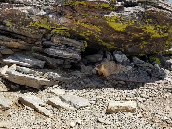
Curious (and hungry) yellow-bellied marmot
Sadly, despite numerous warnings in RMNP, ignorant tourists feed the marmots, ground squirrels, and chipmunks, making them dependent on human food, and a real nuisance to hikers hoping to have a peaceful snack at the summit.
The views were spectacular, and the weather could not have been better! Of course, my first action was to take a 360-degree video!
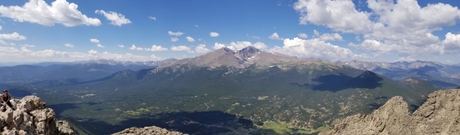
Panorama looking west: Meeker and Longs Peak in the center
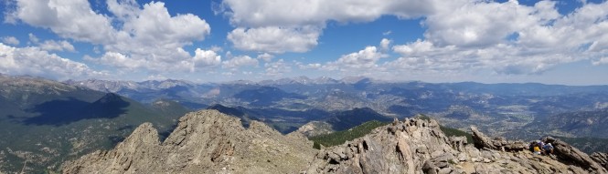
Panorama looking northwest to RMNP and the Mummy Range
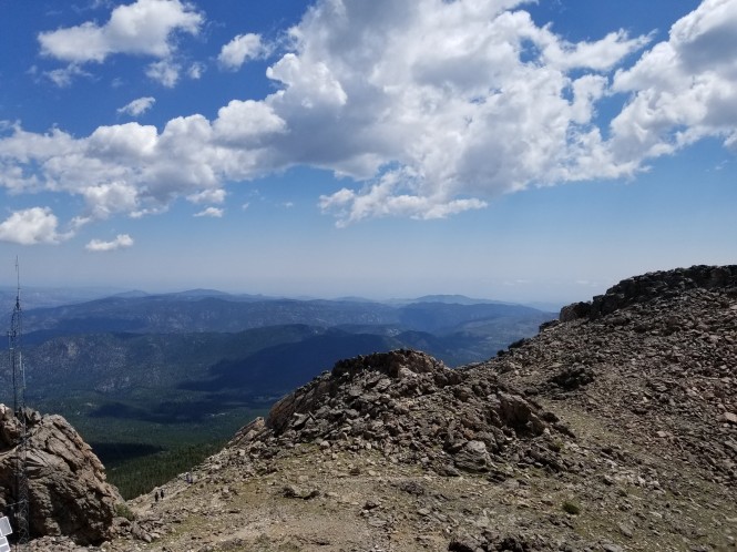
Looking east
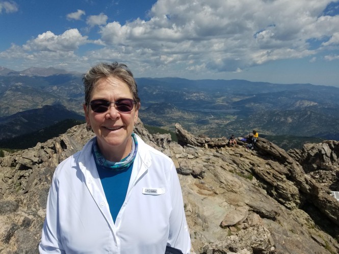
Yours truly, amazed that we made it, with the Estes Valley below!
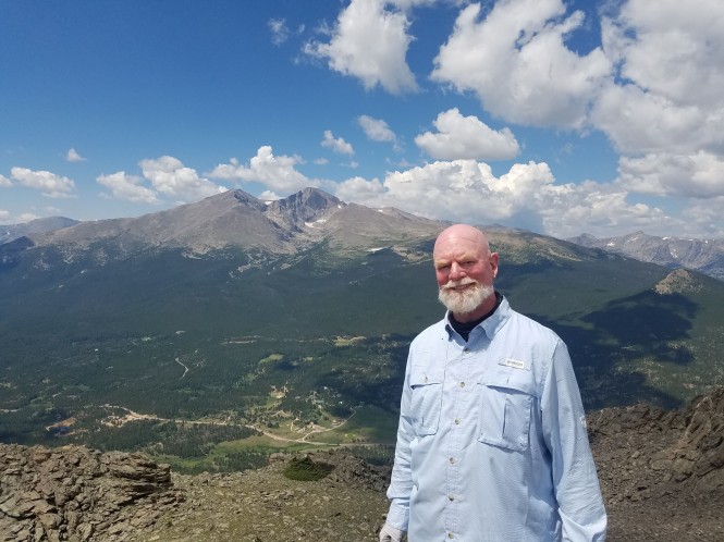
My love, with the fabulous Meeker and Longs in the distance
Stunning northwest views of RMNP and the Mummy Range!
We enjoyed our picnic lunch with the incredible views and then began our descent. As we crossed the boulder field, we could see Jim just reaching the edge of the treeline. It was going to be a long and slow descent for him this day.
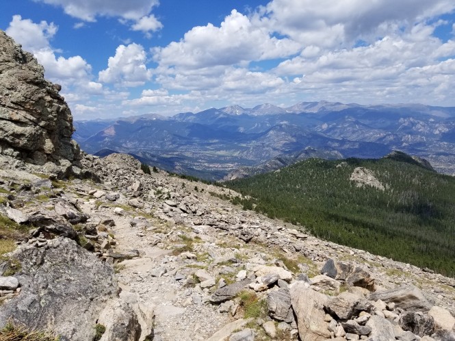
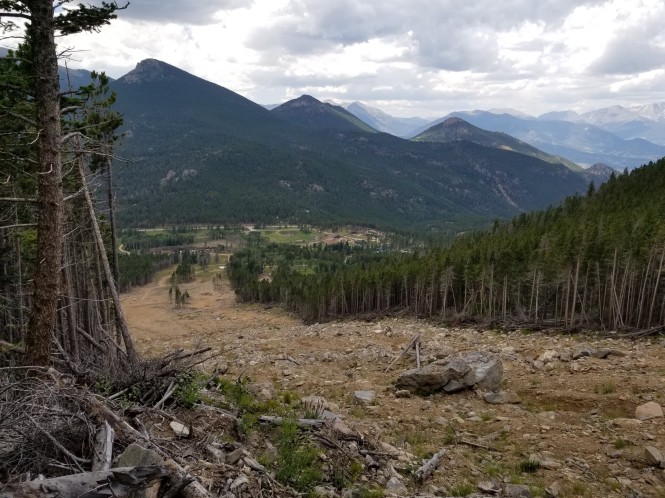
Just entering the treeline, a great view looking north to Lumpy Ridge and the Estes Valley
Peekaboo view, just so beautiful!
We hiked down into the trees and encountered Jim again. We stopped to chat with him and asked if he would like for us to hike with him a while. He was adamant that we could not go as slowly as he would. But he thanked us for asking. We continued, feeling unsettled about his ability to reach the trailhead before dark.
As we descended the switchbacks on the south side of the landslide, we marveled that we made it up at all! It was sooo steep! Amazing how the descent can make you realize just how steep a hike was on the way up.
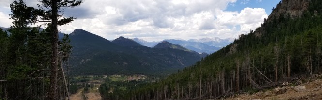
Panorama just before crossing the landslide
Still amazed at the gash in the landscape
Once back in the trees, we began to hear distant thunder. Immediately, we worried about Jim and the fact that he would be exposed to the elements for a great deal longer at his pace.
About a half mile from the trailhead, this happened. Fortunately, we had been caught in rain and hail on our Kruger Rock hike and so we were prepared with big hats and rain jackets.
For probably the last mile, we encountered literally a crowd of camp kids and adults wearing shorts, tank tops, and looking totally unprepared to hike, much less hike 7+ miles in increasingly dangerous weather, with rain, hail, and thunder and lightning. Makes you wonder…
Meanwhile, we made it back to the truck, slightly wet, definitely tired, but accomplished. Still thinking about Jim and wishing for his safe return, so that he can complete his last hike on Flattop Mountain.
Twin Sisters was a challenging hike, with breathtaking views, and counted as our 4th summit hike in the area. 😀 If you’d like to continue reading about more Estes area adventures, click here!


[…] If you’d like to read the next installment of our adventures Around Estes, click here! […]
LikeLike
Wow!! We totally need to get off the beaten path.
LikeLiked by 1 person
Lynn there are some incredible places to explore out here, that is for sure! 😍
LikeLike
I’m constantly amazed at the number of people I see setting out on a hike in shorts, tank-tops, and even flip-flops, with no water. Makes you wonder if they think they are at Disneyland instead of a wilderness area.
LikeLiked by 1 person
Me too, JD, me too. SMH
LikeLike
Thank you for sharing such an awesome hike to Twin Sisters, the views looked incredible. I hope Jim made it back safely too! I think doing something you love is the ultimate happiness and I’m sure Jim was living his bliss on this hike😍🙏! Safe travels!
LikeLiked by 1 person
Thank you for such a lovely comment! Yes, I have to think Jim loves hiking so much he takes his time in order to savor the experience. 😍
LikeLike
I really enjoy reading your posts about Rocky Mountain National Park. Twin Sisters was my first hike in RMNP and will always be a special place for me. You captured it well!
LikeLiked by 1 person
Thank you so much, Kelly! We loved all of Rocky, but Twin Sisters was our daily view, so it was super special! Thanks for visiting and the kind words. We will be back at Estes Park campground at Mary’s lake for more hiking in May! 😍
LikeLike