
Yes, folks, another post about Rocky Mountain National Park (RMNP), one of the most spectacular parks in our very spectacular National Park System. This time I have a story about a hike that started out mild and ended up wild! As usual, this hike took place a couple of weeks ago, on August 9th. We thought some of the summer crowds might be dissipated due to school starting in some areas of the country, so we headed off to the most popular trailhead in the park, Bear Lake, where you can access no less than 10 magnificent hikes. Warning: This is a long post with tons of pics. 🙂
Well, as is the case most mornings in the summer, Bear Lake parking was full, so we parked at the Park and Ride facility and hopped on a shuttle bus to the Bear Lake Trailhead. I say ‘hopped on’, but actually we caught the second shuttle after we joined the line since the first one reached capacity before we got to board. This is the price of a wonderful park, I guess, crowds.
We arrived at the trailhead about an hour after leaving the campground and started hiking toward The Loch, which is about a 6-mile round trip. We had talked the night before about going to Sky Pond, 10 miles roundtrip, but that morning we weren’t feeling the distance. The start of the hike is the same from Bear Lake; you head off toward Alberta Falls, which we had hiked to in the early days of our stay in Estes. It is about a mile each way, not aggressive, and with beautiful views of the falls. We were feeling great at this point and headed past the falls after a quick photo opp.

The always-beautiful Alberta Falls
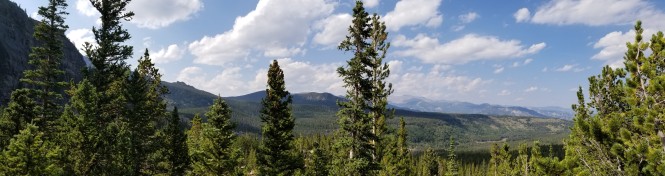
We stopped and admired the view once we got above the trees and could see further into the park.
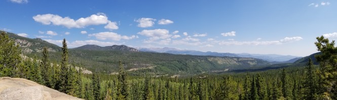
The panoramic view above Alberta Falls

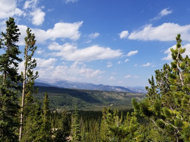
Flattop Mountain, ~9 miles roundtrip, on our list to hike
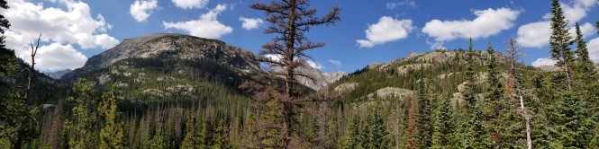
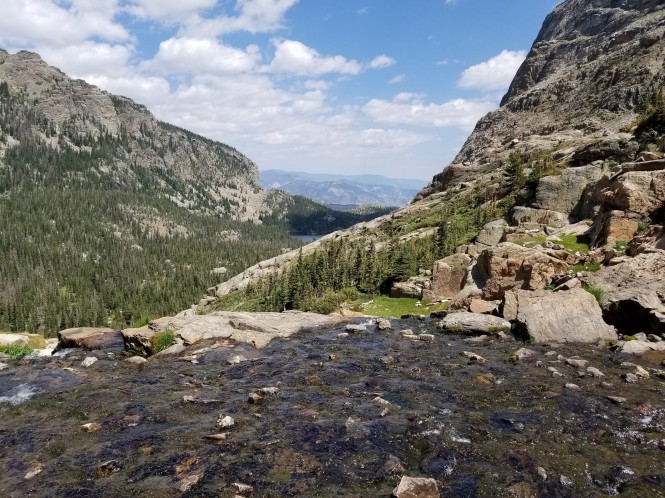
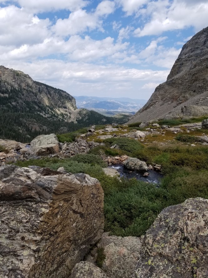
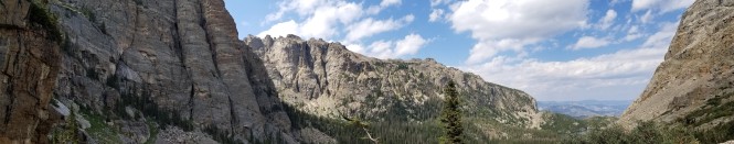
Another gorgeous panorama a little further up the mountain
At a little over two miles in, we reached Mills Junction, the turnoff to Mills Lake and Black Lake. We kept going towards The Loch at this point. We then started hiking up a deep gorger along Icy Brook, which cascades down the valley as you begin hiking more steeply upward.
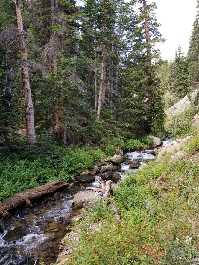
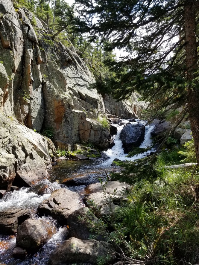
Icy Brook before the really steep part 😉
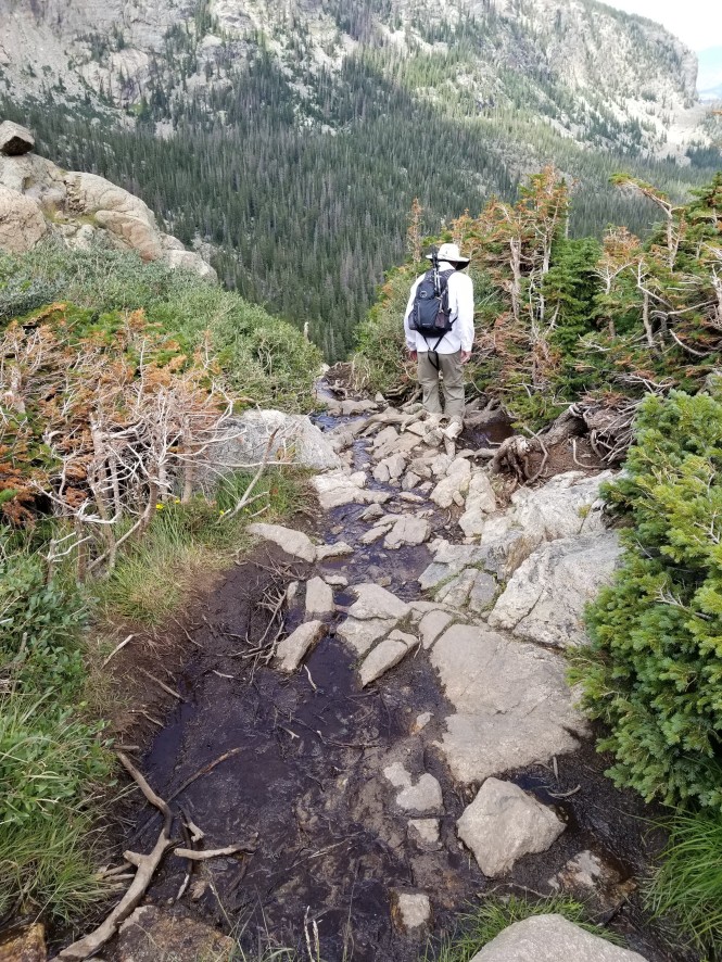
Then the climb became serious, and we hiked along an impressive gorge through a series of switchbacks that were no joke. Icy Brook continued to accompany us, the sound of the water soothing despite the effort.

Beautiful view of Icy Brook cascading down the gorge
Jerry ahead of me in the hat on one of the switchbacks
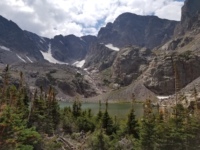
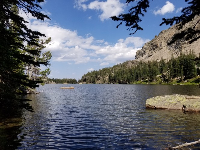
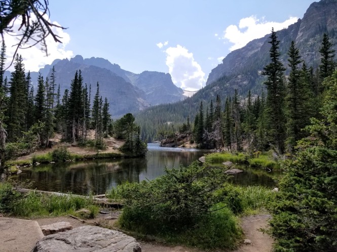
At about 2.8 miles, we reached The Loch, named for the Scottish, Gaelic, and Irish term for a lake. We had previously met hikers at Alberta Falls who raved about the beauty of The Loch. It did not disappoint!

First view of The Loch

The Loch framed by Thatchtop Mountain to the left and Mount Taylor to the right
At this point, we decided to hike on to the northern end of The Loch and decide whether to continue or head back.
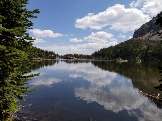
A beautiful reflection from the north end of The Loch
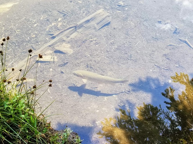
One of the locals…I wish the photo showed the rainbow color
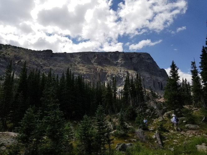
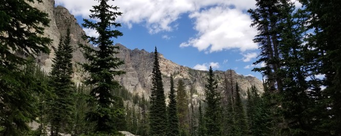
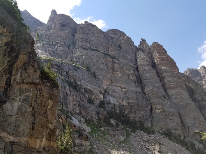
We were feeling good, so we decided to hike on to Timberline Falls. We had read about the entire Sky Pond hike, including Timberline, and the descriptions of the falls were impressive, so on we went! The gorge walls and rock formations were impressive as we hiked toward the Falls.
We were still climbing, and the stone steps and boulders were a real workout! We took the opportunity to observe the beauty and rest now and again. 😉
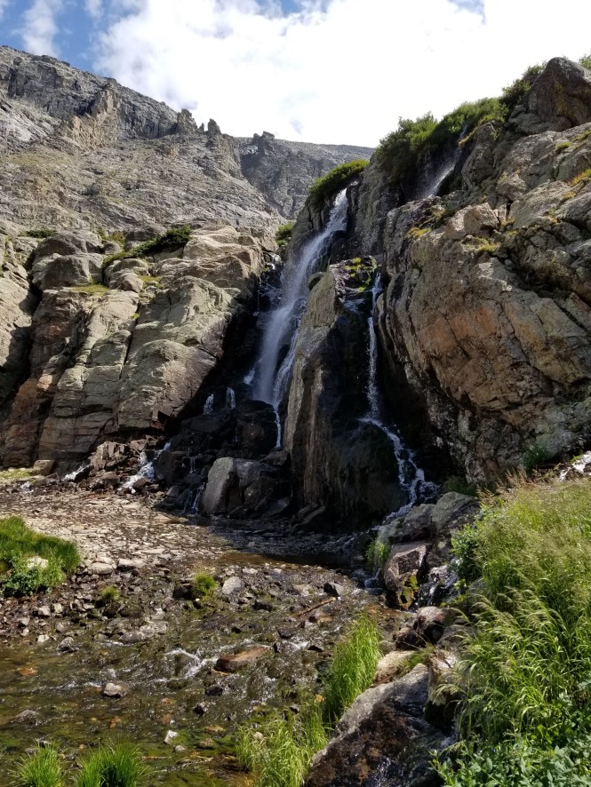
About 4 miles in, after a short rock scramble at the end of the stone steps, and there it is, Timberline Falls! The angle of approach is not the best view, so I hiked across the base of the waterfall to get better photos and video.
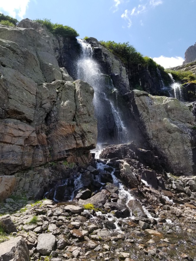
Timberline is spectacular and requires a video to fully experience the beauty.
And a view back down the mountain toward The Loch from the base of the waterfall
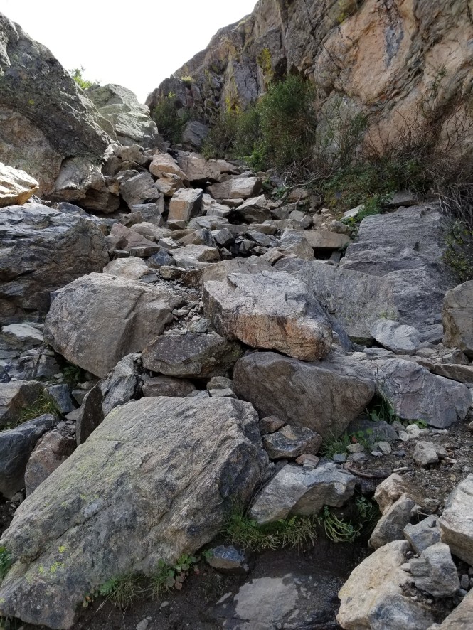
At this point, we knew we were only about a mile from Sky Pond, so we decided to go for it! This hike is unusual in that you have to climb up through a chute at the edge of the waterfall to proceed up the trail. This is a challenging scramble that climbs about 100 feet, requires handholds and the use of all four limbs while ascending, and has water flowing down the rock. I felt a little trepidation about this, not being an experienced rock climber (or a rock climber at all), so there are no photos of the climb up, but we made it! There will be a few on the way down…
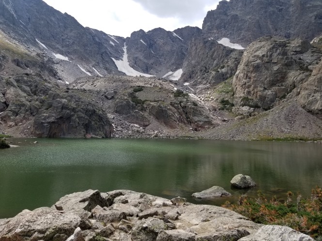
There is another lake just above Timberline Falls called Lake of Glass. It is gorgeous, and I believe many folks may arrive there and think they have reached Sky Pond because there were many hikers behind us that we never saw at Sky Pond or on the way back down. We were on a mission, so I only have one shot of Lake of Glass.
Jerry at Lake of Glass, about 4.5 miles up from Bear Lake
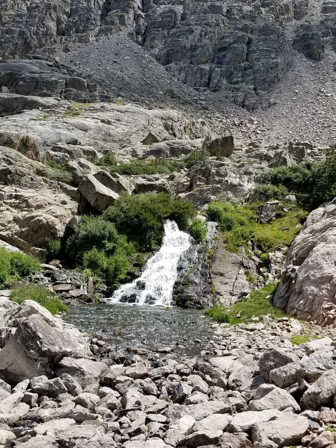
A small waterfall between Lake of Glass and Sky Pond
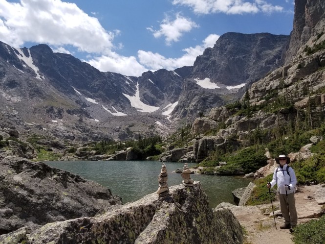
The trail became more rugged and rocky as we passed around Lake of Glass. And then we reached the main attraction: Sky Pond! It was hard to believe we were 5 MILES up from Bear Lake and had scrambled up switchbacks, stone steps, a flowing waterfall, AND a boulder field to get here and we MADE IT! Woohoo!
Sky Pond: The mountain peak to the right is 13,153-foot Taylor Peak
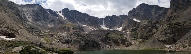
Panorama of the glacial cirque that contains Sky Pond
The alpine lake fills a cirque basin and is surrounded on three sides by sheer cliff walls. The views are incredible!

Off to the right are the granite spires of The Sharkstooth
And the obligatory 360-degree video, please ignore the hiking app interruption! 😉
We settled down by the lake for our picnic lunch while enjoying the views, and there was only one other couple there. So peaceful to have the place nearly to ourselves!
Our picnic lunch view
Reluctantly, we began our hike back down, although the weather was beautiful so we were not under threat of storms, fortunately. As we started back toward Lake of Glass, we caught this incredible view.

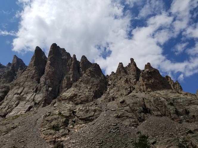
And one more shot of the Sharksteeth
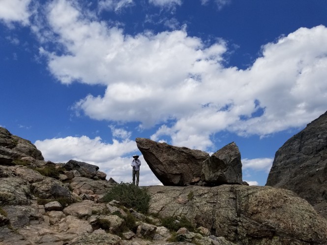
Jerry with an awesome rock just past the boulder field

Closeup of red-orange algae in Lake of Glass
Alpine ponds between Lake of Glass and Timberline Falls
Jerry at the edge of the climb down Timberline Falls
Since I didn’t document the climb up the waterfall, here is a slideshow of Jerry and the view on the way down. 😉
Looking back up at the climb from the bottom!
Last shot of Timberline Falls
Panorama of the gorge from the falls
Majestic gorge walls
Views of the hike just below the falls in a slideshow.
It was at this point, where we met both young and old hikers huffing and puffing their way up, that we realized just how tough a hike we had completed (so far). And we weren’t done yet!!! There is nothing easy about hiking down a really steep slope, but we kept putting one foot in front of the other and enjoying the amazing scenery as well.

Jerry on the rocky switchbacks
Icy Brook heading back down the gorge with us
Back at the north end of The Loch – only 2.8 miles to go!
The south end of The Loch – still amazing!
We were seriously tired now, but feeling accomplished. We did not stop at Alberta Falls on the way down, mostly because it was packed with people.
We did stop for one last overlook of the mountains. I never tire of the extreme beauty of this park.
Looking down on the Bear Lake Valley
We made our way to the Glacier Gorge parking area and caught the first shuttle back to the park and ride. We were lucky because, like Alberta Falls, it was packed with people waiting for the bus. On the bus, and in the car later, we reflected on the day. We had extended a 6-mile hike to a total of 10 miles, making Sky Pond our longest hike to date. We were tired but also had a great feeling that we completed a huge hike, and no one died. 😀
For another post on our exploits in Rocky, albeit much less ambitious, you can go directly here.


[…] If you’d like to go directly to the next RMNP post, click here. […]
LikeLike
Beautiful photos and I love the waterfall video!
LikeLiked by 1 person
Thank you, T! 😀
LikeLiked by 1 person
So beautiful! Every hike is better with water…especially when no one dies! 🙂
LikeLiked by 1 person
That’s our favorite saying now…after several challenging hikes! 😎
LikeLiked by 1 person
Wow ! that is gorgeous! we need to put that on our list.
LikeLiked by 1 person
Thanks, Lynn! It is definitely worth the effort! 🙂
LikeLike
Hi! You commented on my blog, so I thought I’d look you up. Wow, this post is amazing! I think 2 more years of trying to get into better shape might put me into this hike! Absolutely stunning! Lots of rocks!
LikeLiked by 1 person
Thanks, Bridget! I have been following Richard for several years and have really been enjoying your photos and chatty version of his posts! 🤣 I’m glad you enjoyed Sky Pond. Look around when you have time…I have a lot of posts from our summer work camping in Colorado.
LikeLike
[…] Above Nymph Lake, the trail ascends through amazing rock formations, and one particular outcropping provides an incredible viewpoint of Nymph, below, and the majestic valley that contains Sky Pond. […]
LikeLike