
On Friday, May 3rd, we had a spectacular weather day in Buena Vista, Colorado (BV); high about 60 degrees and brilliant sunshine. This was fortunate since we had decided to break out the motorcycles for the first time since San Antonio, but of course, we had checked the weather first to choose this beautiful day. 🙂
Last year, I learned from Colorado Springs-based blog friend Michael at Motoventures about a scenic drive west and north of BV called the West Elk Loop, but on our visit to BV last spring, we didn’t have the motorcycles, and we ran out of time. So, we had the perfect opportunity on this visit. May is still early spring in the mountains of Central Colorado, so the first step was a check of the CDOT website for closed mountain passes. Unfortunately, part of the loop, Kebler Pass, between Crested Butte and Hotchkiss was closed. Oh well, we were going to make the best of it anyway!
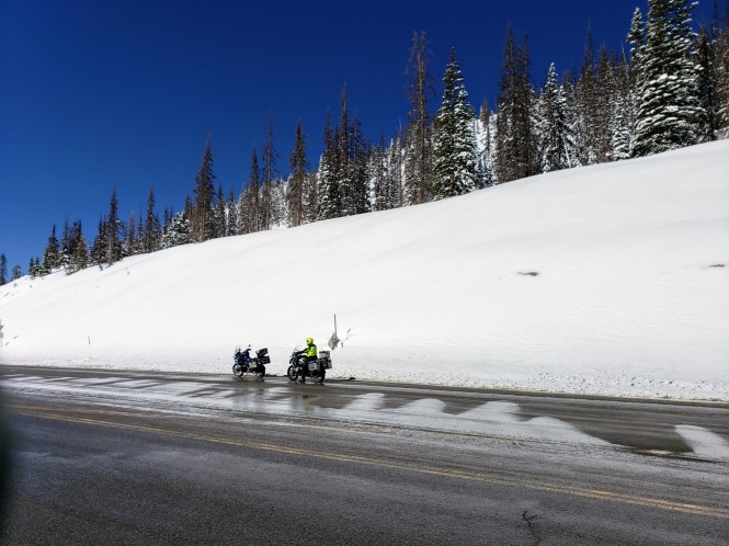
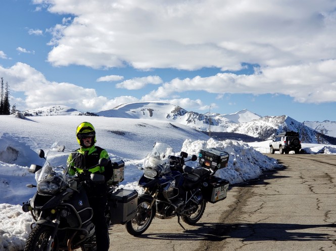
We headed south on US 285 from BV to the intersection of US 50 and then due west. We passed through beautiful rocky canyon walls and could see the mountains surrounding Monarch Pass as we approached. I was a little concerned, as the roads got increasingly slushy as we ascended. We pulled over at Old Monarch Pass to snap some pics and check out the scenery.


A couple of guys were unloading a snowmobile and an odd contraption that was part motorcycle, part snowcat from a large flatbed trailer.
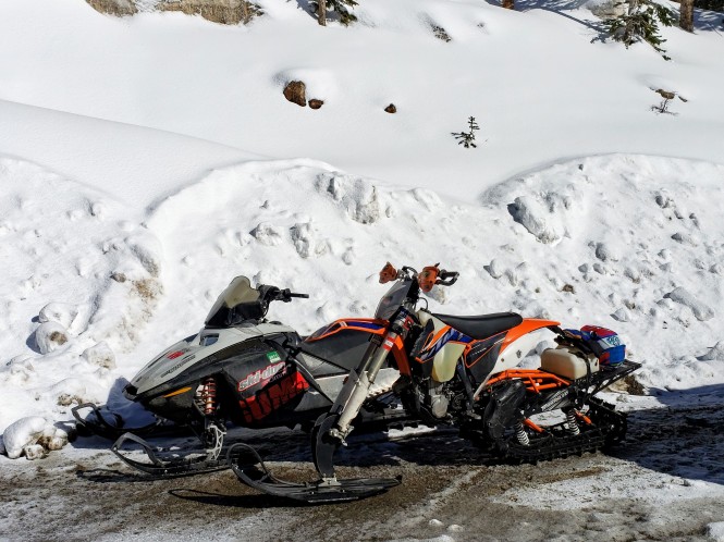
Snowmobile in the back, moto-snowcat in the front
We chatted with them and after commenting that he would like to have our 1200cc engine in his ride, the moto guy offered a demonstration. Oh boy, this should be fun! YEEHAW 😀
What a hoot that must be! I can think of one word to describe many Coloradans we have observed: Fearless!
We ventured on up to Monarch Pass. The road was still slushy, but not icy, so we pulled over for another brief photo op.
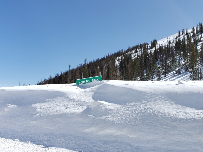
The Pass sign was buried in about 10 or 12 feet of snow!
Jerry waiting patiently 🙂


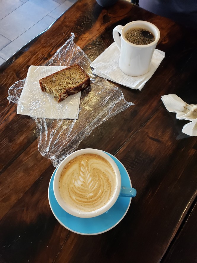
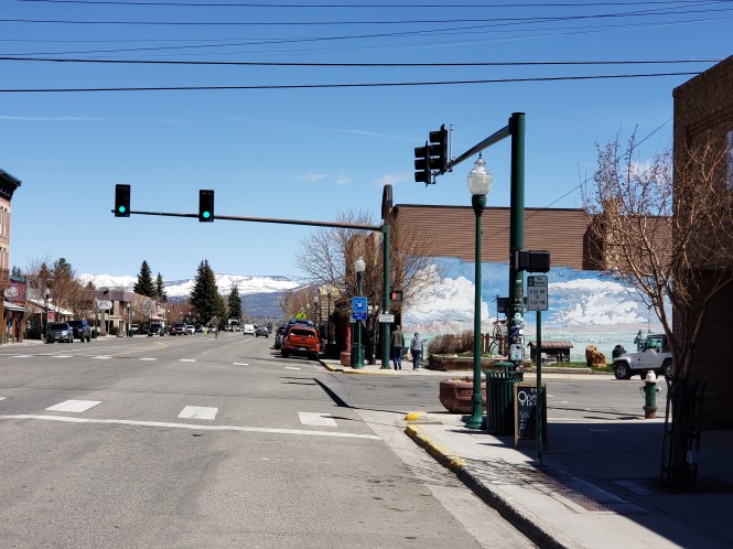
The descent from the pass was spectacular, with snow-covered mountains eventually giving way to sheer rock cliffs, then to evergreen slopes, and finally, into an arid valley, punctuated with glistening creeks. We passed through Dawson Creek (!), then followed Tomichi Creek into Gunnison. We never do this when we ride, but we decided to stop for a coffee break and dawdle a bit. Fun. Tributary Coffee roasters had just what the dawdler ordered; coffee, a beautiful latte, and a piece of luscious banana bread.
A couple came in, ordered drinks, left, and then returned a few minutes later to chat with us about our ride, where we are from, etc. They must have seen our Florida plates! LOL Anyway, they were very nice and after asking about us, shared that they owned places in BV and Santa Fe, so they appreciated our nomadic lifestyle. The people you meet when motorcycling are always so interesting.
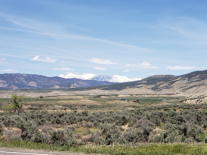
In Gunnison, looking north toward Crested Butte
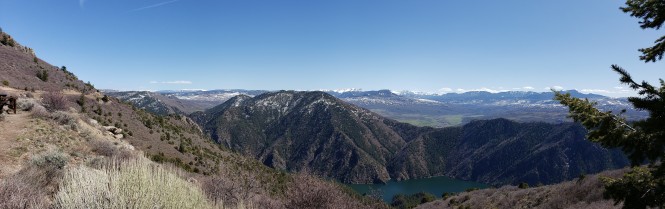
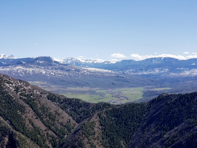
In the photo above, that tiny blue scenic road sign says “West Elk Loop”. Unfortunately, the pass above Crested Butte was closed so we would miss that northern portion of the loop, and we proceeded west on US 50, on the southern part. US 50 runs through the stunning Curecanti National Recreation Area, a 50 mile long series of three reservoirs, the best known of which is Blue Mesa, offering expansive views and recreation opportunities all along the way. Blue Mesa was seared into my memory from a long-ago visit, and it was still beautiful despite the water level being low to allow for spring snowmelt.
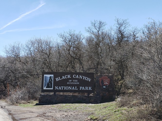
Our next stop was a National Park we had visited years (many years!) before on a cross-country motorcycle trip, Black Canyon of the Gunnison. Thanks to Jerry and his National Parks Senior Pass, we don’t hesitate to visit any NP unit we may come across. I’ve written before about this pass only allowing one motorcycle entry, but this kind ranger let us both in. 🙂 Black Canyon is one of those parks that you cannot adequately describe…it leaves you speechless. Sculpted over millions of years by the power of the Gunnison River, its staggering cliffs and mosaic of colors are impossible to capture. But, of course, I tried.
The 16% grade East Portal Road down to the river was still closed for the season, so we made do with a couple of scenic overlooks, starting with Tomichi Point. This viewpoint looks toward the Gunnison Diversion dam on the Gunnison River, which sends life-giving water to the previously arid Uncompahgre Valley. We were amazed at the lush and productive agriculture that is now possible in this former desert valley as we rode through later. But I will now let the photos attempt to do the overlook justice!
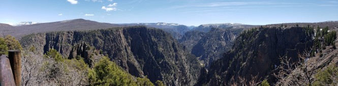
Panorama at Tomichi Point
And a little show of what riding through slush and snow will do for your bike. We did wash them the next day…oh the horror! 😀


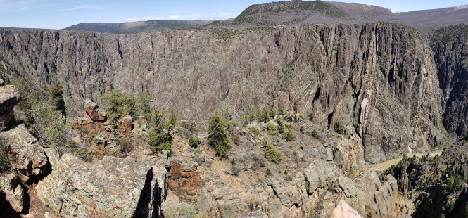
Our next stop was at the South Rim visitor center, where we watched a brief video about early exploration of the canyon and the building of the Diversion dam for irrigation, and then we went out and peered over the edge into the abyss! Like the Grand Canyon, there is no way to really capture the magnificence of this natural wonder. Here’s my attempt.


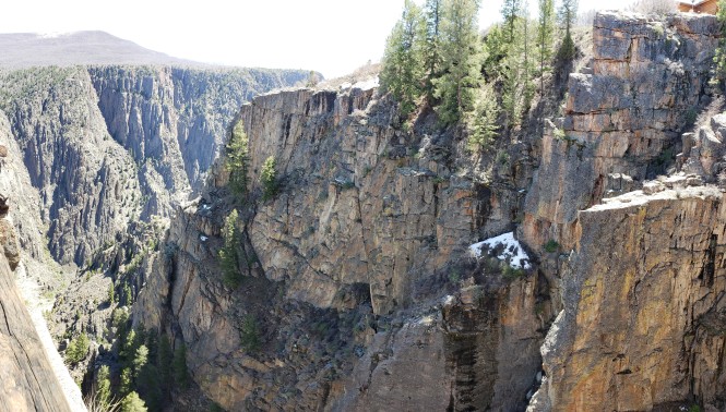
Black Canyon is spectacular, and we only saw the tiniest part this visit, but would highly recommend a more in-depth visit when the weather is warmer and you can ride down into the canyon and see the river. Maybe next time!
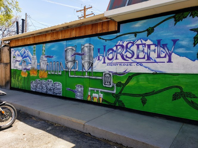
We continued on US 50 to Montrose and stopped for fuel for both bikes and riders. We lunched at Horsefly Brewing, which had a great patio with seating in the sun, which was welcome on this chilly day. Also, loved their motto: “No crap on tap”. Teehee.
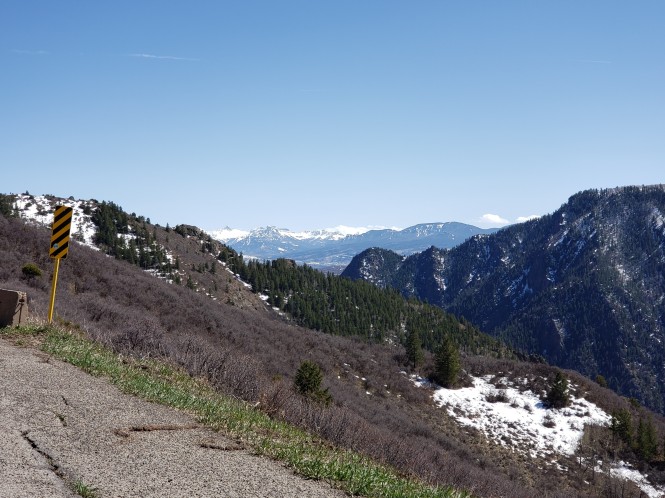
Montrose is the northern end of US 550, aka “The Million Dollar Highway”, which was tempting, but we were on a mission for as much of the West Elk Loop as we could manage. So we continued on US 50 through Olathe and then to Delta, two small towns in the agricultural Uncompahgre Valley that I mentioned earlier. We headed east on CO 92 at Delta, and passed through Hotchkiss, and near CO 133 that goes northeast to Paonia, and follows the West Elk Loop over Kebler Pass to Crested Butte. Since it was closed, we continued on 92, where the landscape was very lush and that caused lots of bugs, so we had to stop and clear our face shields. Splat. But it was a great excuse for a photo op!
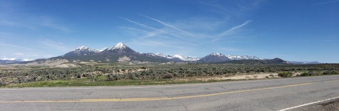
Panorama looking Northeast
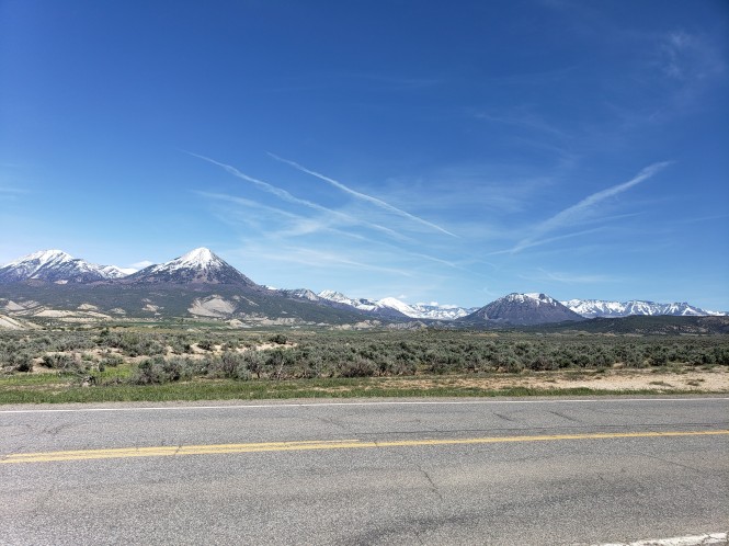
Looking North
CO 92 heads south, and descends fairly steeply, then east, on the north side of the long Curecanti National Recreation Area, which we had previously viewed from the south bank. The views were stupendous as we rode, and we stopped a couple more times for photos, the first time on the side of the road in the Gunnison National Forest, captivated by this view!
Looking southeast from CO 92 near the Crystal Creek Trailhead
We continued south until we saw the Hermits Rest Picnic area. We were ready for a stretch, a walk around, and some hydration anyway, and of course, more photos! 😀 There is a nice picnic shelter, restrooms, and a trailhead for a 3-mile hike down to the elusive Morrow Reservoir. The catch is that it is literally 3 miles straight down to the water, and of course, 3 miles back up! And unless you are in a boat, that is the only way to reach Morrow. We chose to admire the reservoir from the top. Ha.
Panorama from Hermits Rest picnic area
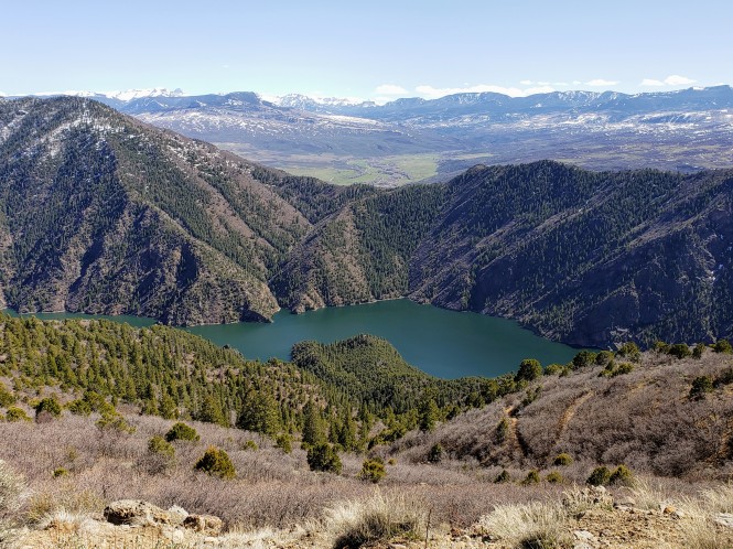
Showcasing Morrow Reservoir
The long-range view, looking south. Mountains for days!


After we soaked in the beautiful views and hydrated, we rode on toward US 50 and headed back east. It was getting late, and I have to admit I was getting worried about the slush freezing on Monarch Pass, so we did not stop again. Until the pass, that is! And fortunately, the road was dry as a bone.
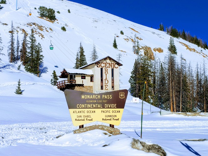
Monarch Pass: 11,312 feet at the Continental Divide
Jerry waiting patiently in spectacular surroundings
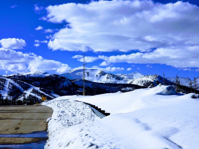
Incredible views!
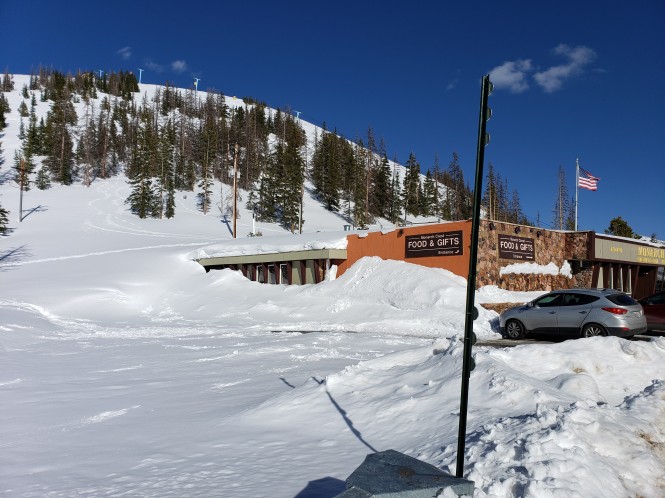
The store at the pass was still mostly buried in snow
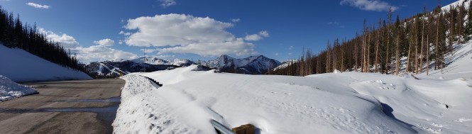
Monarch Pass panorama
Thanks for coming along on our ride…we hope to finish the West Elk Loop at some point, but have lots to share from our more recent travels, so stay tuned!


Beautiful area! Though some of the areas look kind of slick. I had never heard of Black Canyon before. Pretty impressive!
LikeLiked by 1 person
It was really wet in the morning, but perfectly dry by PM. Black Canyon is definitely worth a visit if you are anywhere near central Colorado, Richard! 😊
LikeLike
You are grabbing life by the throat. I love and respect this.
LikeLiked by 1 person
Thank you, Cindy! We have been so busy that I am literally months behind in my blog reading…but I have all your fabulous post links saved to read soon! Thanks for sticking with me despite the delay! 😍
LikeLike
Wow! What a ride. We’re slowly working our way up. We do NOT like the cold. We don’t like hot either. We’re an equal opportunity weather hater LOL. So we’re zigging around embracing warm/cool weather. Love your photos and rides. You guys are fearless!
LikeLiked by 1 person
I have seen your FB posts but am months behind in reading all blog posts…one day I will catch up!!! We absolutely LOVE the cold and snow so this has been a perfect year!! Thanks for reading and commenting…we’re giving it all we’ve got till we ain’t got it no more, LOL.
LikeLike
I’m not a fan of snow, but this post was AWESOME!
LikeLiked by 1 person
Considering your location, I can understand your dislike of snow, but I sure am glad you enjoyed the post! 😊😍
LikeLike